The art and science of missing person searches

Police departments are using the technology at their disposal to find people who have gone missing. Barry D Smith explores what makes for a successful operation
Few things are more terrifying for a family than to have one of its members become lost or go missing. Panic can set in as the imagination takes over and creates the worst possible scenarios. Hundreds of search and rescue (SAR) teams around the world have been created to bring the lost and missing home. Most are volunteers. Using technology and local knowledge of the area, these teams work long, physically tough hours to save lives.
Behavior and geography
One of the busiest SAR helicopter units in the USA is the Utah Department of Public Safety Aero Bureau.
“We cover the entire state with two bases, one in Salt Lake City in the north and St George in the south,” explained Chief Pilot Luke Bowman. “The state has a vast variety of terrain. We have tall mountain ranges with thick forest in the northern section close to Salt Lake City that are very accessible, so people easily get in over their heads as far as difficult, technical terrain. We also have a large number of people who practice extreme sports. There are also vast open areas, especially in the southern part of the state, that are a magnet for hikers and explorers. There are many narrow canyons, called slot canyons, that are only a few feet wide but hundreds of feet deep, that attract thousands of hikers. We average 350–400 missing/lost person searches every year with about 160 hoist rescue missions a year.”
The unit has three Airbus H125 helicopters that rotate among the two bases. One ship is usually in some kind of maintenance cycle, so having three allows them to staff both bases at all times. Each is equipped the same. They use the WESCAM MX-10 camera system with a Shotover mission management system for the augmented reality (AR) mapping system. They use the Garmin G500 electronic flight instrument system (EFIS) with a Garmin G650 GPS as well as a Garmin autopilot.
“The autopilot has the capability to generate and fly grid search patterns,” commented Bowman. “It works best in open desert areas. We fly at about 100ft over the ground at about 60kts when doing these type of search patterns. We also use iPads with tracking software to record our searches to keep track of where we have searched. A lot of SAR agencies use the CalTopo mapping system and we can load our search information directly onto that to show where we have searched. That allows the ground and air units to display what areas have been searched and determine if more coverage is needed or they can move on to new areas.
We fly at about 100ft over the ground at about 60kts when doing these type of search patterns. We also use iPads with tracking software to record our searches to keep track of where we have searched
“In the deep canyons of southern Utah, we often play the role of airborne communications relay for the ground teams that lose radio contact due to the terrain. These canyons also make it difficult for victims to use cell phones and other communication devices. We are currently working on a grant to install the Lifeseeker cell phone location device on our helicopters. This would be very helpful in the steep canyons.”
He added: “Our electro-optical and infrared (EO/IR) camera system is very helpful. We use the IR to detect targets and then use the EO camera to take a more detailed look. Many of the narrow canyons get no daylight in the bottoms where people might be located, so the EO/IR cameras are very helpful in searching these areas.”
Bowman stated that the aviation unit is there to support the local sheriff, who has legal oversight of all SAR in their county. Their search managers determine the best areas to search based on all the information they are able to gather.
“When we are searching, we try to think like the victim and anticipate where they may have gone,” he said. “We can also see the paths of least resistance they may have traveled much easier from the air. We also often will transport dog teams to high-probability areas. By transporting them by helicopter, it reduces the fatigue of the dogs, who can usually only work for a few hours.”
There has been a lot of research into the behavior of people who are lost. This can help to get into their mindset to try to predict where they might have gone after the last known sighting. However, it can be very difficult to predict the behavior of certain types of missing persons, for example, Alzheimer’s patients.
“We have also had many cases of missing autistic children,” Bowman said. “Some will actually try to hide from searchers because they are afraid of strangers or think they might be in trouble because they left. Some research has stated that autistic people are drawn to water. Knowing this, one search that involved an large area concentrated on bodies of water. The subject was found sitting in a river.
Some will actually try to hide from searchers because they are afraid of strangers or think they might be in trouble because they left
“One successful tactic we have used is to have a family member record a message for the victim and we can play that on repeat through the helicopter’s public address system. We also use this tactic for small children who might be afraid of the helicopter.”
Lost in California
Fixed-wing aircraft play a significant role in missing/lost persons searches. The California Highway Patrol is split into eight divisions. Each has its own air operations unit with both helicopters and fixed-wing aircraft.
“The California Highway Patrol is currently using three different airframes for its fixed-wing program,” stated Sergeant Joe Airoso. “Our newest aircraft is the Cessna 208 Caravan. We also use the GippsAero GA8 Airvan and the Cessna 206.
“The Caravan is a multi-mission aircraft. It was selected based on our operational needs and ability to operate in all areas in California. California is a large and very geographically diverse state. We have mountains, coastal regions, and vast areas of desert, so we needed an aircraft that could operate effectively and efficiently in all those areas. The current plan is to transition to the Caravan as the legacy aircraft are retired.”
We have mountains, coastal regions, and vast areas of desert, so we needed an aircraft that could operate effectively and efficiently in all those areas
The Caravans are each equipped with the Garmin G1000 NXi EFIS with a Garmin GFC 700 autopilot as well as a Garmin GWX 8000 weather radar. They use the Shotover ARS-750 AR mapping system along with an L3Harris MX-15 EO/IR camera. Each also has the ability to download real-time video from the camera system. Starlink and cell phone capabilities are also installed. A full suite of law enforcement and public safety radios are available to the crew.
“The Caravan brings a lot of capabilities to a search mission,” Airoso said. “The Garmin EFIS has a search and rescue enablement, which allows us the fly specialized search patterns to cover terrain more accurately. The nice thing about the Caravans is that we have very long loiter time versus other aviation resources. We can cover large areas very quickly, as well as fly much higher than other resources. We can fly anywhere from 3,000–8,000ft above ground level. Our camera system is so advanced, we can see well that high above the ground. With a crew of two and full fuel, we can stay in the air for six to seven hours. We typically loiter at about 120kts.”
He continued: “Another one of our duties during a search mission is to act as a communication relay for the ground teams. In very rugged mountains and canyons, the ground teams may not be in radio contact with their base or other ground teams. Due to our ability to fly at high altitudes, we can act as a relay station for the various ground teams and even helicopters that might be flying in canyons. We do a lot of outreach with our allied partners in law enforcement and SAR. This allows them to become familiar with our capabilities and what we can and cannot do. Our attitude is ‘What can we do to help you complete this mission?’”

Drones
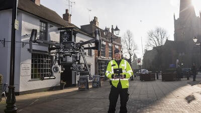
An increasingly important tool for searching for missing/lost persons is the uncrewed aerial vehicle (UAV) or drone. Hundreds of SAR organizations around the world have found them to be very useful and cost-effective tools. They have many of the capabilities of a helicopter at a fraction of the cost. They can carry both color and IR camera systems, whose images can be downloaded and stored for later review, as well as being viewed in real time by the UAV operator and other personnel via downlink.
The small size of the UAV and its maneuverability allow them to get into places no human can safety venture. This is especially true of searching in rivers and lakes. Water bodies are often surrounded by thick vegetation that can be hazardous to searchers, especially in flooding situations. A UAV can slowly hover along the waterway only a few feet from the surface, which keeps searchers safe and increases the possibility of detecting victims.
In 2022, a glacier partially collapsed in the Dolomite Mountains of Italy. Eleven people were killed and eight injured. The ice and rock rubble was considered too dangerous to send in search teams, so UAVs with IR cameras flew over the area and were able to find the exact location of the injured, who were then rescued.
IR cameras are very effective as they detect the heat of a victim and can be prominently displayed on the operator’s screen from a great distance. However, IR is not a panacea. Thick trees and foliage can block the view of the system. Rain and thick fog can also decrease the range the IR camera can see. In addition, in deserts and jungles, the high heat and humidity can heat objects to the same temperature as humans and decrease the effectiveness of the IR camera.
Rain and thick fog can also decrease the range the IR camera can see. In addition, in deserts and jungles, the high heat and humidity can heat objects to the same temperature as humans and decrease the effectiveness of the IR camera
Another limitation of UAVs is their battery life. The smaller systems often have a battery life of less than an hour. However, being able to switch out batteries can greatly increase their flight time.
Time is a precious commodity in SAR. With the camera systems mounted on UAVs getting more sophisticated, the large amount of data being collected is taking longer to adequately analyze. Unless the presence of a person is fairly obvious on the operator’s screen, video needs to be properly reviewed for signs of the victim. This is where artificial intelligence (AI) is beginning to have an impact on SAR. Several commercial companies as well as some educational institutions are exploring AI and how it can increase the effectiveness of video analysis for SAR UAVs.
A hiker was missing for 10 months in the Dolomites. A SAR team wanted to test the effectiveness of an AI SAR system. They took a series of 2,600 high-resolution photographs in a high-probability search area in very steep and rugged terrain. The same day, an AI program targeted several suspicious spots that contained colors not normally found in that area. When weather allowed, searchers discovered the red climbing helmet of the missing person and subsequently his remains. Other AI search programs are beginning to look into interpretation of audio signals to identify people calling for help.
Much like with the military, it takes boots on the ground to complete a successful SAR mission. However, the technology available in helicopters, fixed-wing aircraft, and UAVs offers a speed and efficiency never seen before. The result is more lives saved and greater safety for the searchers.
The Utah Department of Public Safety (DPS) has been using a rescue device called RECCO, made by a company based in Sweden. It is a two-part passive system designed to locate missing persons, and most commonly used to find buried victims of avalanches. The system uses harmonic radar. When the radar signal hits a reflector on the victim, it is reflected back to indicate the location of the victim. The small reflectors, weighing less than 4 grams, are permanently attached to clothing, helmets, and boots at the manufacturer's factory. Over 150 brands have been installing the reflectors in their products. There are handheld detectors as well as larger ones that can be carried under a helicopter by a cable.
RECCO is completely passive and requires no batteries or switches to activate. Most people who have the chip in their gear don’t even know it is there. The system is used by over 900 ski patrol and SAR teams around the world. Utah DPS was one of the first agencies in the USA to use it. Chief Pilot Luke Bowman said:
“We have found several avalanche victims using the device, but so far we have no live finds.
“We want to use the RECCO device before the ground team arrives, so reflectors in their gear won’t set off the RECCO detector. We typically fly a RECCO search with the detector about 50ft above the snow at about 20–30kts airspeed. If we get a hit, we will fly lower to try to isolate the signal and throw out a marker for the ground teams to start digging.
“If it is a backcountry avalanche in a remote area, our helicopter is usually first on scene. If we see indications people might be buried, like ski tracks leading into the avalanche but none leading out, we will start a RECCO search. If we get a hit, we will immediately fly out to pick up ground searchers, who can start digging the victims out.”
July 2026
Issue
As another July rolls around, it’s wonderful to bring you the airborne policing edition of AirMed&Rescue. We have features on the development and strategies used during aerial missing person searches; the active threats that affect aviation and law enforcement services particularly; the bread and butter of police aviation, the patrol and support operations; and the increasing use of drones as a force multiplier and sometimes as a first responder.
Barry D Smith
Barry Smith has been an aviation and emergency services writer/photographer for over thirty years. He has published over 250 magazine articles and six books. He has also worked in emergency services as a paramedic, volunteer firefighter, and member of search and rescue teams for over 40 years.