

Far-sighted

Remote territories are seeing new military and emergency services investments in surveillance drones. Rob Coppinger investigates the latest aerial vehicles in use for special missions
Both the Arctic and the Antarctic are to be visited by remotely piloted aircraft systems (RPAS) this year as European, Australian, and Canadian armed forces, and their coast guards, prepare for the highest and lowest latitudes.
Operating in a zone with a degraded visual environment and limited infrastructure is going to be very testing but intelligence, surveillance, and reconnaissance (ISR) capabilities can mitigate these obstacles. Whether it is mapping, imaging ground conditions, delivering supplies or search and rescue (SAR), sophisticated RPAS and simpler, commercial-type drones are helping security forces cope with all and any conditions. The Danish military has established a new squadron to start operating drones in the Arctic, and the Canadian Coast Guard is also preparing to evaluate an Elbit Systems StarLiner RPAS in the High North. For the lowest latitude, the Antarctic, the Australian government’s Department of Defence operates commercial drones from an icebreaker.
During the southern hemisphere’s summer, from about 1 December to the end of February the following year, the Department of Defence supports the Australian Antarctic Program’s operations. The program’s scientists there have a million-year-old ice core project that aims to extract 3km-deep samples. The scientists are supported by the Defence Department’s icebreaker RSV Nuyina, which carries drones and their operators.
“We did have helicopters on board and small boats, but we found we were often operating the drones in conditions that we couldn’t operate helicopters or small boats in. Which was a bit of an eye opener for a lot of people,” said Australian Antarctic Division RPAS expert Dr Doug Thost. He was referring to a mission to Heard Island, a remote Australian territory that has the nation’s only active volcano. But Heard Island is not in the Antarctic circle, it is considered a Sub-Antarctic island. Dr Thost works on RPAS operations and development and is the Deputy Chief Remote Pilot for the Australian government’s Department of Climate Change, Energy, the Environment and Water.
At the other end of the world, the Canadian government needs to map its Arctic regions because the last time that happened was 70 years ago. “Well, we haven’t mapped our Arctic since 1956, so it would help immensely, but probably only on a localized basis,” said Transport Canada’s RPAS Director, Mark McKeeman. “Communities are expanding, infrastructure is expanding. Being able to do a high-resolution pictorial map of any area could be beneficial to any number of government departments. Being a Coast Guard and DND [Department of National Defence], getting some aerial resolution mapping that’s georeferenced and all of those good things, for any of the military and Coast Guard installations, could be beneficial.”
The ability for operators to be able to make best use of the tools at their disposal is incredibly advantageous, Scott Richardson, VP of Product at CarteNav, said: “Two things make [the flexibility of the CarteNav AIMS-ISR] matter. The first is that we have deliberately kept our focus on software functionality. It means making sure AIMS-ISR is universally compatible across very different screen sizes, hardware capabilities, and form factors. The payoff is that the operator can put the software wherever the mission needs it, from a small tablet to a full mission computer, and swap components out for affordable off-the-shelf hardware when they need to.
“The second is that it lets us meet a wide variety of concept of operations (CONOPS) without needing to know in advance what they will be. One Australian operator chose to run on 11 commercial laptops rather than ruggedized machines. Every 18 months or so, they simply purge the machines, reinstall the software, and they are back on the latest and greatest without having to think about it. Set against the cost of a full mission system and its support tail, it was far less expensive. That is really the point: flexibility of form factor and resilience in how the product is sustained throughout its life.”
Transport Canada is the Canadian government’s transportation department and it is planning to procure an Elbit Systems StarLiner RPAS, a drone that looks like a General Atomics Aeronautical MQ-9B SkyGuardian with the bulbous fuselage nose, long fuselage with a wide, thin wing, and a V-shaped tail with a pusher-propeller. McKeeman and his team are carrying out the contractual acceptance phases of the contract. The StarLiner is described by Elbit as a medium-altitude, long-endurance unmanned aerial system (UAS), and it can fly for 36 hours. Its maximum payload is 450kg, and its service ceiling is 30,000ft. In 2028, the Royal Canadian Air Force is also expected to take delivery of the first of the actual SkyGuardians it has separately ordered.

Cold War squadron
The Royal Danish Air Force is procuring four General Atomics Aeronauticals MQ-9B SeaGuardian RPAS, according to Denmark’s armed forces website, and the Air Force has re-established a Cold War squadron for their operation. With the first of the MQ-9B to be delivered in 2028, Denmark intends to expand its monitoring, photo reconnaissance, and surveillance in the Arctic, around Greenland and the North Atlantic, and the Baltic Sea. These RPAS will also be deployed to support environmental monitoring and SAR operations.
The re-established squadron is 729 Squadron, a photo reconnaissance unit in the Danish Air Force that operated from
1955–93. According to the Danish government, 729 played an important reconnaissance role during the Cuban Missile Crisis. The new 729 Squadron will be part of the Danish Air Force’s Air Transport Wing and will operate from Aalborg Air Base in Denmark. A ceremony was held for the establishment of the new 729 Squadron on 16 February this year at Aalborg Air Base.
The drone can be deployed rapidly, covers a much larger area than a patrol vessel, and provides extremely sharp imagery
Another North Sea nation, Belgium, had a drone operated from its northern coast from May until July by the Belgian Coast Guard. In the Coast Guard’s 20 May announcement, the Commander of the Belgian Navy, Admiral Tanguy Botman, said: “The drone can be deployed rapidly, covers a much larger area than a patrol vessel, and provides extremely sharp imagery.” These images are shared in real time with the operator and the Coast Guard centers. In the longer term, the Belgian Coast Guard’s ambition is to deploy this form of maritime surveillance permanently.
The drone is a Schiebel helicopter S-100 UAS that has been provided for a third consecutive year through the European Maritime Safety Agency’s Multipurpose Maritime Operation (MMO). Denmark’s MQ-9B SeaGuardian could be controlled by satellite communication “pole-to-pole”, according to the manufacturer General Atomics Aeronauticals, and it has de-icing capabilities. The aircraft can be fitted with a number of payloads including a maritime surveillance package with a 360-degree maritime radar. It can also carry sonobuoy dispensing pods. The MQ-9B can search the ocean’s surface and its depths in support of naval fleet operations.
At the bottom of the world, Dr Thost’s Australian Antarctic Division operates a commercial quadcopter, the DJI FlyCart 30 with a Riegl VQ-840-G bathymetric laser scanner payload. The Division also operates the DJI Matrice 400 quadcopter. “A lot of other people were pretty surprised that we could operate in conditions up to a ship heave, at its worst, of 9 meters and in winds gusting to 40kts,” Dr Thost commented. Ship heave is movement in the vertical direction. “Our biggest concern was that the aircraft wouldn’t even be able to perform with the ship moving quite violently. But they did actually perform really well. It is quite puckering, sort of trying to take off and land on a ship that’s heaving that much in those sorts of winds. But once you’re away from the ship and doing stuff there, the gimbal-stabilized cameras are pretty amazing these days.”
Our biggest concern was that the aircraft wouldn’t even be able to perform with the ship moving quite violently. But they did actually perform really well
Richardson explained that sometimes the questions that need solutions aren’t always the obvious ones: “We abstract away from the platform. Whether it is a single drone giving us a single feed, or a highly capable aircraft carrying a full sensor suite, we do not rank them by importance; any one contribution can turn out to be the tactical piece that matters. What we care about is that it all arrives in the same common operating picture, with a consistent user experience behind it.
“The harder problem, and the one we specialize in, is what happens once the data is there. When you are taking feeds from a number of UAVs and sensor platforms at once, the risk is not too little information but that there is too much of it. So, our work goes into filters, alerts, decluttering, and track correlation: bringing it back in a form the operator can actually act on within a time-critical window. And with a drone specifically, the question the crew is asking is usually not where the aircraft is; it is what is the feed showing them, and where do their areas of coverage sit. That is what the software has to answer.”
StarLiner
While the Australian Antarctic Division has been operating commercial quadcopters for some time, the StarLiner was only delivered last October. “We did some ground testing and then this spring, initiated in April, we started assembly and ground testing,” McKeeman explained. “And we’re now in the process of doing our training. We had pilot and maintainer training as part of our contract, so that [contractual acceptance] exercise is taking place this summer.”
In August, the StarLiner is being shipped to Iqaluit, a shoreline civilian settlement in the Nunavut territory of Canada. From Iqaluit, by boat, the Labrador Sea can be reached and on the other side of that is Greenland.
“[Iqaluit is] where we want to complete our contractual acceptance. We have some requirements in our contract for flights up to 72 degrees north [latitude] and for flights in the northern domestic airspace,” said McKeeman. “Of course, we have to be up there to be able to verify those requirements. Iqaluit is the base that we’ll be operating out of in the Arctic.” The latitude of 72 degrees north runs through Canada’s Nunavut territory and Greenland. The Arctic Circle begins at 66 degrees north latitude.
Between 46 and 60 degrees south latitude is the Sub-Antarctic and Dr Thost, his Antarctic Division, and the military have used an Australian-made drone there, the Freespace Operations Callisto 50 logistics drone. Dr Thost and his military colleagues put a 12kg Riegl VQ-840-G bathymetric laser scanner on the Callisto. “The defense guys were helping us operate that in one of our Sub-Antarctic stations on Macquarie Island, which is about three days sailing southeast of Australia,” Dr Thost commented. He added that with Heard Island, the DJI drones used on that island “allowed us to get much closer to wildlife than we would have been able to with traditional aircraft”.
The drones used on Heard Island allowed us to get much closer to wildlife than we would have been able to with traditional aircraft
The Belgian Coast Guard’s use of a Schiebel drone is also wildlife related. The European Fisheries Control Agency (EFCA) has been supporting the operation. The helicopter UAS takes off from a military base in Lombardsijde town on the North Sea coast where a temporary operational base was set up. While this has been the third consecutive year for this drone’s use, it was the first time it was operated from Belgium. During 2025 and 2024, the drone was operated from a French base near Calais. In the 20 May announcement, Dr Nathalie Balcaen, Coast Guard Chair and the Maritime and Coastal Services Agency Administrator-General, said: “Thanks to this technology, authorities can respond more quickly and in a more targeted way in one of Europe’s busiest and most sensitive maritime areas.” The drone can efficiently detect illegal fishing, human smuggling and transmigration by sea, vessels failing to use the mandatory automatic identification system (AIS), marine pollution, and other violations, enabling more targeted enforcement.

Having a technology that actively benefits continuous operational improvement from the missions it is deployed on is something that CarteNav are particularly aware of, Richardson said: “Something we have learned recently is that scope and urgency [of post-mission reviews] matter, because there are really two cadences to it. Some post-mission reporting is so time-sensitive that it has to be near real-time. The question there is what you can pull straight off a live platform to generate an information package that can move immediately, while it still changes the outcome.
Some post-mission reporting is so time-sensitive that it has to be near real-time. The question there is what you can pull straight off a live platform to generate an information package that can move immediately, while it still changes the outcome
“Then there is the slower cadence, which is where the learning actually happens. Once you have flown a number of missions over a period, you can start asking cross-mission questions. Because every platform shares timestamping, you get geotemporal queries: at this time, in this space, what could we actually see? A good example is coverage trending, effectively heat mapping: where did you have sensor coverage across a mission, and did you get the coverage you believed you had? If an automatic identification system (AIS) track came through your local operating picture, was your sensor genuinely looking when it did?” Richardson added: “Alongside that we hold the mission data itself: synchronized video, tracks, maps, and events for interactive review, with key-length-value (KLV) metadata supporting 3D debrief. And it is not always our tools. A lot of the value is being able to hand that information to other post-mission analysis systems so it can be blended into a wider picture.”
Last December, the Belgian Navy conducted the first training flights of the Skeldar V-200 uncrewed helicopter from Ursel airfield, northwest of Ghent. Over the next few years, the Navy wants to expand its fleet from its two V-200s to 10 and operate them from Belgian naval vessels. The Skeldar V-200 is a rotorcraft drone with a rotor span of about 4.5m and a maximum takeoff weight of 245kg. Its endurance is up to six hours, depending on the payload. The training flights focused on pilots’ familiarization with the flight systems and maintenance. The ground station for the pilot is inside a special freight-like container and can be used on land or at sea.
The trials conducted at Ursel were carried out in close collaboration with the Royal Netherlands Navy. There are three piloting modes for the Skeldar. They are manual piloting, with the direct adjustment of trajectory, speed, and altitude; an automatic mode on a predefined route; or third, a flight according to a programmed pattern. One of the V-200’s roles will be mine detection. “Thanks to its data link, the Skeldar allows us to conduct mine countermeasures operations at greater distances,” explained Captain Kristof Van Belleghem, Belgian Chief of Staff of the Navy. “We can also use it to detect drifting mines and thus enhance the ship’s safety.”
Each domain contributes something different. A maritime platform gives you a slower-moving but robust and highly capable sensor suite at the surface. Airborne buys you distance and coverage. Ground gives you persistence and consistency from a known position.
The complexity of missions across multiple domains is not an issue for a system that is optimized for multiple inputs, said Richardson: “We are not concerned with the platform of record or where a given sensor happens to sit, so you are able to draw on the best of all of them. Each domain contributes something different. A maritime platform gives you a slower-moving but robust and highly capable sensor suite at the surface. Airborne buys you distance and coverage. Ground gives you persistence and consistency from a known position. You will pick up different things from each depending on where it is, and that is a feature rather than a complication.
“So we are platform agnostic in the same way we are hardware agnostic – agnostic in how the software works, while still recognizing that each domain has its own value proposition. The core benefit is what comes after that: how do you draw all of those platforms and their individual views back into a single picture that a decision-maker can actually understand and act on? That’s the problem we solve.”
The domains that were once thought out of reach to drones, the harsh Arctic and Antarctic, are now becoming accessible to even commercial products. The seas and oceans that link them all – the Atlantic, Labrador, Arctic, North, Indian, and Southern – can be traversed by drones small and large. High wind speeds and degraded visual environments are not the obstacles they once were. Delivering supplies, SAR, law enforcement, ISR, mapping, and imaging are all tasks that can be carried out without risking the lives of naval, air force, or coast guard personnel.
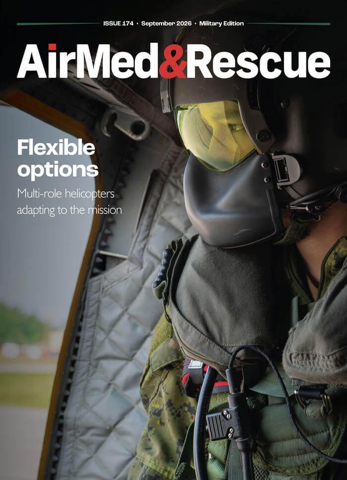
September 2026
Issue
As we reach the equinox, I’m happy that we have an interesting military edition of AirMed&Rescue for you to read on those longer nights. We have features on the benefits of governmental institutions having a multipurpose helicopter; why military operators are at the forefront of exploring optionally piloted aircraft; how uncrewed aerial vehicles are serving as platforms for sensors that can operate in extreme situations; and on the equipment that is essential to carry on board an emergency medical services aircraft.
Jon Adams
Jon is the Editor of AirMed&Rescue. He was previously Editor for Clinical Medicine and Future Healthcare Journal at the Royal College of Physicians before coming to AirMed&Rescue in November 2022. His favorite helicopter is the Army Air Corps Lynx that he saw his father fly while growing up on Army bases.