

Latest aircraft onboard system sensors

Sensors provide critical data that ensures safety and success for helicopter and fixed-wing missions. Jennifer Ferrero speaks to the manufacturers and special missions operators about the demands of the sector
Sensor technology is an umbrella term for navigation, safety, health, and flight control systems. It is rapidly evolving in private medevac missions, helicopter emergency medical services (HEMS), and search and rescue (SAR).
AirCARE1 uses long-range Bombardier Learjet 60 aircraft for medevac services in North, Central, and South America. Its mission is to offer high-quality medical care and patient transport across distances. Snohomish County Volunteer Search and Rescue (SCVSAR) Helicopter Rescue Team offers HEMS and SAR services and works with local police and sheriffs’ departments to locate dementia patients, criminals, and people lost in its deep wilderness. Original equipment manufacturer (OEM) Robinson Helicopter Company has been around for over 50 years, and, with a new president at the helm, is innovating new sensor systems that will revolutionize the helicopter industry. Its use of drones to pre-evaluate disaster situations may be the new model for efficiency.
Pilot systems have evolved from steam gauge instruments to high-tech, even artificial intelligence (AI)-enabled models. Today’s tech is changing the game for improved rescue and enhanced crew safety. At the end of the day, new technology does come with a cost, but with add-on systems in existing craft, it is possible to upgrade to electro-optical, infrared, and hyperspectral systems to provide enhanced results.
Denise Waye, President of AirCARE1 International, is an innovative nurse turned medical air transport service expert. In 2003, Waye worked for other medevac services and decided she could offer something different. Today, her business operates across continents, transporting critically ill patients to treatment in her two Learjet 60s.
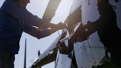
Chris Fischetti, a pilot who now serves as Director of Operations for AirCARE1, said he started with “steam gauges” early on but now uses a variety of sensors to serve their patient base.
Waye said: “AirCARE1 provides air ambulance medical flights and patient transport on our fleet of Learjet air ambulances. Each Learjet is outfitted with the most sophisticated medical equipment to serve as an in-flight ICU, meeting patients’ needs.”
Fischetti said that adding high-tech sensors to the aircraft was “value for money, absolutely”. He shared that their onboard weather radar came from the factory with the aircraft”. The Traffic Alert and Collision Avoidance System (TCAS) is usually an additional charge on the aircraft, but the Learjet 60s came with that equipment. “Everything has operated with the TCAS system; the cost is in the tens of thousands to install it, but could vary depending on the type of aircraft.” Still, he said the TCAS was, at a minimum, a “sensor” system they needed.
Adding high-tech sensors to the aircraft was value for money, absolutely
The Snohomish County Rescue Team is an all-volunteer group based in Snohomish County, Washington, USA. Jennifer Stollwerck is an Emergency Medical Technician (EMT) in the local fire department, and also serves as a volunteer pilot on the team. Their location in Washington state comprises 663,000 acres of forest, posing difficulties during SAR operations due to limited visibility. Luckily, they use a variety of sensors to navigate through the forest to reach medical rescues. Bill Quistorf has served as a Chief Pilot, with his primary role as a Certified Flight Instructor and trainer on night vision goggles (NVGs), which are widely used in the area.
Stollwerck spoke to the forward-looking infrared (FLIR) heat sensor system display, describing the system’s accessibility to find patients in urban and rural environments. She said it was mounted below the helicopter, but in the deep forest, they can see the heat signature of movement on their two MD 500 helicopters. They also use TRAKKA Systems, which provide enhanced capabilities compared with their older model. The system is used for heat sensors in forests, tree and green-belt areas, and urban areas, on the SAR side and for finding lost dementia patients. They also use it to work with law enforcement and help the police department track suspects they are trying to apprehend. It provides heat signature searches in the trees. Ultimately, they can find people and provide services.
Robinson Helicopter is an innovative OEM in sensor products for its small-to-medium-sized utility helicopters. President David Smith said: “We are working on a lot of advanced sensors that will be industry first.” He cited the importance of continuing to address sensor applications. One reason they are focused on sensors is that over the past 20 years they’ve seen, on average, two wire strikes a year beyond their control on the aircraft, usually due to pilot or crew factors. He said these were all preventable and that the company was aiming to use sensors to improve customer safety.
Modern technology
One newer sensor product uses lidar and high-resolution 3D mapping, combined with AI, to detect and display a visual indication when a helicopter approaches a wire strung between two points along its flight path. Smith explained: “Aircraft hits a wire, loses control, and ultimately leads to a fatal accident. Some are in agriculture; some have been on charter or private flights. Depending on the risk, the tech includes laser-based scanning to navigate at a speed fast enough to give a pilot a warning,” which ideally provides time for the pilot to avoid a collision. This could be especially helpful in the rescue work that Stollwerck and Quistorf are called to do in western Washington for SCVSAR. With private and forest service land, being able to see the wires’ bright glow on their iPad monitor could save their lives. Smith said visibility would be about 200 yards out.
Depending on the risk, the tech includes laser-based scanning to navigate at a speed fast enough to give a pilot a warning
Robinson is investing in other sensor technologies for its light utility aircraft and is particularly focused on expanding its work in the air medical industry. Smith said that, in a medical application, “pilots on mission are coming in on an active roadway, not to an airport, but they all have the same challenge. We are trying to do everything we can; sensors will play a big part in that.”
One of their many partnerships for new sensor development is with Lake Fusion Technologies, for helicopter terrain awareness and warning systems (HTAWS), which blend lidar and cameras. He said part of their evaluation was how this information would display. Ideally, he said, it would be a multipurpose screen they are using for other applications. Their partner/supplier is conducting testing before adding it to Robinson’s products. Hyperspectral imaging in airborne missions is gaining traction as well and allows the use of both cameras and stabilizers for data collection.

Doing different jobs
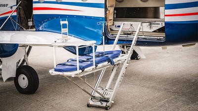
Air medical, SAR, and HEMS airborne missions all have different sensor requirements. Regarding AirCARE1’s missions, one of the main reasons they can fly across continents, such as between North, Central, and South America, is the flight data recorder (FDR), which is required in Mexico, for example. A similar, useful product for Snohomish County is NVGs, which are needed when flying at night. Conversely, AirCARE1 doesn’t use NVGs because it flies under instrument flight rules (IFR) rather than visual flight rules (VFR), unlike Snohomish, for its fixed-wing aircraft. Regarding flying IFR or VFR, Fischetti said: “Even when we are operating with IFR, we are visually looking for traffic at all times.” He said traffic or collision avoidance had become an increasing challenge, wherein sensors are critical.
According to Mordor Intelligence, “the Traffic Collision Avoidance System (TCAS) market is projected to grow significantly, with an estimated value of US$608.86 million in 2026 and reaching $771.92 million by 2031. This growth is driven by increasing air traffic and safety regulations, particularly in commercial aviation.” AirCARE1 said it had redundancy on several sensor systems, but TCAS was the most important to them.
On the low end, you have drones that have cameras and infrared and color; they are tiny, but it’s amazing how accurate they are; images will be sent back to the person’s phone or tablet
Regarding the “value for money” of which sensors to add, Quistorf reflected: “On the low end, you have drones that have cameras and infrared and color; they are tiny, but it’s amazing how accurate they are; (images) will be sent back to the person’s phone or tablet.” He said there was a microwave downlink that could send camera images back to a handheld receiver at an emergency management location, and “they can view what we view in the helicopter”. He said this was used around western Washington.
Extending capabilities
Considering drones as auxiliary sensors for helicopters, all interview subjects see both different and complementary uses. As a pilot, Quistorf asked: “Do the drones go out first?” Some deputies use drones for search; they work best in a small area. In mountain rescue, there are times when they can’t fly their MD 500; in that case, they fly a drone. Last year, they had a significant flood in a nearby county that covered over 18,000 acres. He said: “I worked the flood in Skagit County; we had drones flying and searching for people when the weather was bad.” They added that the drones captured images on an SD card for use in their missions.
While Robinson has been less involved in the air medical market, its R88 is expected to be a catalyst. Smith said that, traditionally, Robinson Helicopter has been seen as more of a “small sedan or SUV, whereas, in air medical, you want a cargo van more like an ambulance”. He said the R88 was designed to take a more active role in emergency medical work. “This market will be a big part of our future.” Currently, using their smaller helicopters, they can fly in a doctor or medics to an emergency scene, and then the ground crew can transport the patient via ambulance to the hospital. But the R88, with modern sensors and more space, will answer the call in picking up and transporting patients.
The company also manufactures drones for fire detection, SAR, and other specialty applications. Smith said they use Areté sensors, which are attached to Robinson drones. He said it was a small drone helicopter, weighing 13–15lbs, with a high-quality camera and a computer on board. The application is flying over a trauma scene, measuring the patient’s respiration and heart rate. “It is a combo safety role and emergency services and response with small drones and emergency helicopters to help EMS after a train crash, earthquake, or flood,” Smith shared. He said the combination of helicopters and drones in emergency medical management gets sensors to the point of need. They drop the drones from helicopters, which has several benefits, such as stability in bad weather and pre-informing ground medical teams of what to expect.
The combination of helicopters and drones in emergency medical management gets sensors to the point of need
Waye and Fischetti said that, because their flights were both non-emergent and yet international, they were concerned about safety management systems for each flight. They want to ensure they are prepared for both weather (heat in Mexico and South America, freezing temperatures and snow in Canada) and traffic. They conducted a fourth-quarter 2025 safety assessment and said: “About 30% of flights were tagged as medium risk: icing, clouds, low ceiling, having a designated backup airport, while there is a patient on board.” They also assessed approaches and weather down to minimum conditions. All conditions are potential uses for newer technological sensors as they continue to evolve.
Safer and more efficient
There are rapid advancements in onboard sensor systems for helicopters, focusing on their impact in medevac, SAR, and emergency services. Sensors – such as navigation aids, collision avoidance systems (TCAS), advanced imaging (FLIR), lidar, and hyperspectral technologies – are improving flight safety and operational efficiency. Additionally, drones are increasingly being used as auxiliary sensors, providing real-time data in difficult or inaccessible situations. Overall, the integration of advanced sensor technology is making helicopter and fixed-wing missions safer and more effective across a range of applications.
August 2026
Issue
August is a special time of year, and it is my pleasure to present a special Women in Aviation edition of AirMed&Rescue. We have features on the importance of preventing and knowing the early signs of hoist spin; the leadership roles and the value of visibility of women in the industry; the inward-facing and external sensors improving special missions; and the variety and standards that flight suits have to meet.
Jennifer Ferrero
Jennifer Ferrero owns Ferrero Agency. She focuses her writing on feature stories for aerospace and manufacturing trade publications. She also provides marketing and public relations services. She has been an entrepreneur and writer for over 25 years. She lives in Spokane, Washington.