A successful earthquake disaster response exercise in Austria

The EU-funded DRIVER+ project (Driving Innovation in Crisis Management for European Resilience), which assists those involved in crisis management to find the best ways of coping with disasters, has now completed its fourth and final trial in Austria, which will provide crucial data needed in developing earthquake detection through unmanned aerial reconnaissance prior to the final project demonstration
Following the three previous trials that took place in Poland, France and the Netherlands, the large-scale test in Austria focused primarily on the identification and testing of solutions for overcoming possible shortcomings in the management and support of volunteers. The German Aerospace Center, Deutsches Zentrum für Luft- und Raumfahrt (DLR), generated real-time aerial images to provide essential support for position detection and rescue logistics.
Real-time aerial images enable a quick and accurate assessment of the situation on the ground after a disaster, thus allowing for the efficient planning of relief operations in a targeted manner. As such, DLR was well-placed to use its Do 228 D-CODE research aircraft as a demonstration of how an unmanned aircraft system (UAS) could, in this way, be used for disaster response in a controlled airspace.
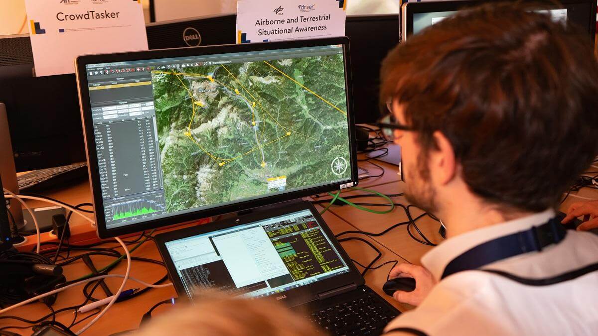
In the demonstration, DLR’s research aircraft was controlled remotely using a new digital autopilot via a datalink – although two test pilots and a flight test engineer from DLR Flight Experiments were onboard for monitoring purposes and to ensure flight safety at all times. Operations managers on the ground were able to identify and mark out areas of interest on a map and transmit them to the unmanned aircraft as a request. This request was then translated into a flightpath in real time, taking account of the current conditions (for example, nearby air traffic, weather, visibility, mission objectives) and automatically flown by the UAS.
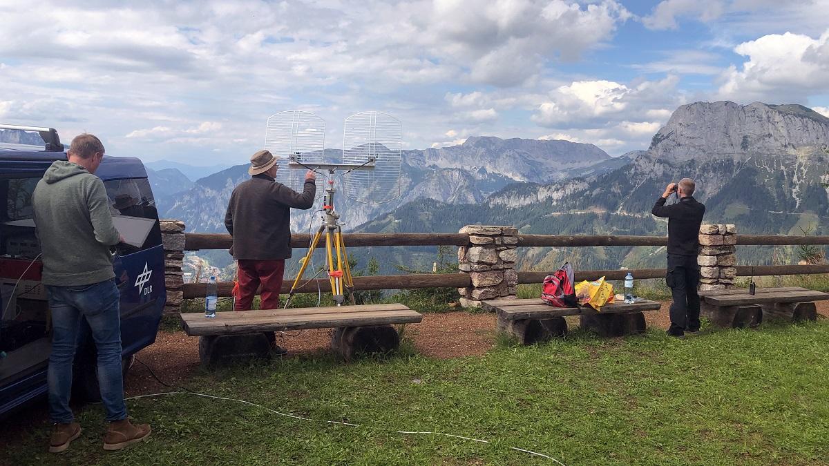

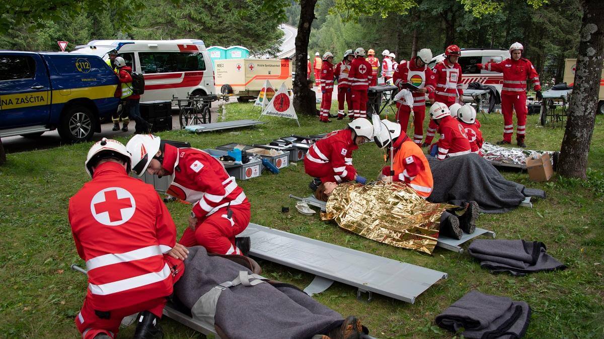
Within minutes, these aerial images were made available to the emergency crews on the ground, who were able to use them to gauge the extent of the damage, co-ordinate rescue teams and search for injured or missing persons. The collected data was also forwarded to the Center for Satellite Based Crisis Information (ZKI) at the German Remote Sensing Data Center (DFD).
Christian Niermann, Project Leader coordinating DLR’s involvement in DRIVER+, commented: “This marks an important contribution to aeronautics research not just in terms of demonstrating the capabilities of a UAS, but also as a further step towards the safe and efficient integration of UAS traffic into general airspace.”
The flight and mission planning for the aircraft was carried out using the UFly ground control station for unmanned aircraft, which was set up by the DLR Institute of Flight Guidance. The research aircraft was equipped with a 3K camera system, which can capture an area of 80 square kilometres in approximately 10 minutes, create geo-referenced aerial images and transmit the results to the ground control station via a datalink. This camera system was specially designed by the DLR Remote Sensing Technology Institute for use during disaster response mission.
Find out more about the project here.