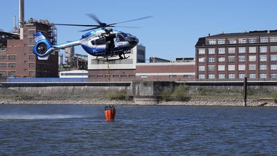
Air patrol and support

Mario Pierobon looks at crew configurations, air–ground coordination protocols, and the integration of emerging technologies, including uncrewed aerial systems, into established airborne law enforcement operations
Airborne law enforcement operations require careful coordination between flight crews, ground units, and command structures to support time-sensitive tactical situations. From routine patrol to high-risk operations, air support units rely on structured mission preparation, sensor technology, and effective crew resource management (CRM) to deliver operational capability across urban and rural environments.
Preparation and aircraft configuration
Casey Kumar, Deputy and Chief Pilot of Air and Marine Operations at St Johns County Sheriff’s Office in Florida, explained that flight crews arrive at the hangar at the start of their shift and conduct a pre-flight check of the aircraft and equipment. “Shifts are flexible and adapt to the needs of the patrol, but last 12 hours. Flight crews check weather conditions, NOTAMs, TFRs, and previous calls. We are supported by a fuel budget that allows us to fly up to three patrol flights per day for two consecutive hours. Weather conditions, call load, and crew fatigue may affect flight duration,” he said.
We are supported by a fuel budget that allows us to fly up to three patrol flights per day for two consecutive hours. Weather conditions, call load, and crew fatigue may affect flight duration
At the National Police Air Service (NPAS), which supports police forces across England and Wales, mission preparation begins with a structured briefing covering weather conditions, NOTAMs, aircraft performance, intelligence updates, priority incidents, and airspace considerations. “Crews then complete a full aircraft tour, mission systems check, night vision goggles (NVG) and forward-looking infrared (FLIR) configuration where necessary, and a CRM briefing to confirm roles,” NPAS affirmed. “Helicopter missions typically last about 1.5 to two hours, while the fixed-wing Vulcanair P.68R can remain aloft for up to eight hours, offering a long-endurance and cost-effective air support capability. Return decisions are influenced by fuel management, changing task priorities, weather developments, and regulated duty and fatigue time constraints.”
Looking at configuration, the St Johns County Sheriff’s Office aircraft is configured exclusively for observation, with an MX-10 camera system with electro-optical and infrared sensors. “The aircraft also features Shotover Systems map overlay, a searchlight, and a public address system, and it is equipped with a Technisonic radio system programmed to communicate with all surrounding counties, allowing us to communicate seamlessly with neighboring jurisdictions,” said Kumar.
Typical equipment on board NPAS aircraft includes FLIR/thermal imaging systems, integrated mission consoles with mapping, overlays, recording, and downlink. “Our aircraft are also equipped with high-intensity searchlights, digital communications for real-time air–ground coordination, and advanced avionics, including terrain awareness and warning systems (TAWS), traffic collision avoidance systems (TCAS), and modern cockpit displays,” said NPAS.
Many mission management systems focus primarily on displaying data or providing isolated situational awareness functions
The ability for on-board technology to enhance operations is clearly a factor for many public safety organizations when choosing a mission suite. Andrea Masini, CEO of FlySight, said: “Many mission management systems focus primarily on displaying data or providing isolated situational awareness functions. OPENSIGHT goes beyond this by creating a real-time common operating picture that fuses data from multiple sensors and sources into a coherent operational view. Another key differentiator is flexibility. OPENSIGHT has been designed as an open-code software development kit (SDK), allowing users to adapt, extend, and customize capabilities according to operational requirements. Rather than forcing operators into a rigid and proprietary ecosystem, the platform enables users to integrate their existing workflows, applications, and mission systems while adding new functionalities over time. Its multi-platform and hardware-independent approach also allows deployment across airborne, maritime, and ground environments, creating continuity between aircraft crews and command centers. Ultimately, OPENSIGHT is designed not simply as a display tool, but as a decision-support environment intended to reduce complexity and improve operational effectiveness.”
Crewing practices
NPAS helicopters are operated with three crewmembers. “The pilot is responsible for aircraft flight, navigation, and airspace management; the front seat tactical flight officer (TFO) manages tactical direction, sensor operation, and communications; and the rear-seat TFO manages mapping, data interpretation, evidence acquisition, and downlink feeds,” explained NPAS. “The fixed-wing P.68R operates with a pilot and a TFO, supported by mission systems designed to allow effective assignment of tasks to each TFO. During dynamic incidents such as active surveillance or pursuits, the TFOs assume the majority of the tactical and communications workload, allowing the pilot to focus entirely on aircraft management.”
Rod Clinch, Chief Pilot and Head of Flying Operations at New South Wales (NSW) Police Force Aviation Command, affirmed that their crews were also made of three persons: a pilot, a mission commander (MC), and a systems operator (SO). “The pilot is responsible for safety of flight and responsive to the MC, who is the tactical commander and controls all tactical radios and law enforcement decisions. The SO is responsible for operating the electro-optics under the direction of the MC,” he said. “Taskings are intel driven or specific to an allocated task. All tasks are triaged based on gravity of the task, distance, and hours available. Where there are protracted tasks, additional resources may be recalled or the patrol support aircraft re-tasked to priority jobs.”
The pilot is responsible for safety of flight and responsive to the MC, who is the tactical commander and controls all tactical radios and law enforcement decisions
At St Johns County Sheriff’s Office, a typical flight crew on patrol consists of two members, a pilot in command (PIC), and a TFO. “The pilot is primarily responsible for flight safety, while the TFO is responsible for the law enforcement mission,” said Kumar. “During patrol, priority can shift from flight to law enforcement depending on what is happening. For example, during takeoff, attention is focused on traffic on the runway, birds, or other obstacles. Once over a law enforcement scene, priority shifts to the mission.
“Patrols are typically given to the flight crew to fly as they see fit. This allows us to avoid any possibility of pattern recognition/predictability. Flight crews are updated on criminal intelligence data by our criminal analyst and can plan a flight based on the information gathered. The maximum distance for intervention is typically left to various levels of supervision. In the past, we have responded to calls in surrounding counties and, at times, across the entire state of Florida.”


NPAS patrols combine intelligence-guided hotspot flying, assignments directed from police control rooms, and pre-planned activities such as rural anti-crime operations and road safety initiatives. “Helicopters remain the primary rapid response asset, typically within a 20-minute window, while fixed-wing aircraft provide long-range/long-distance endurance duties,” said NPAS.
Ensuring the workload of the mission systems operator is efficiently managed is an essential quality of a good system, which can enhance outcomes of the task at hand, explained Masini: “The integration of augmented reality (AR), artificial intelligence (AI), and automatic target recognition (ATR) provides practical operational advantages that can be measured through improved efficiency, reduced workload, and faster decision cycles. During surveillance missions, AI-assisted detection and classification capabilities can significantly reduce the time required to identify vehicles, individuals or suspicious activities within large volumes of video and sensor data. Rather than requiring operators to manually monitor every feed continuously, the system supports crews by highlighting relevant events and objects of interest.
AI-assisted detection and classification capabilities can significantly reduce the time required to identify vehicles, individuals or suspicious activities within large volumes of video and sensor data
“In pursuit management scenarios, AR overlays provide contextual information directly on operational displays and video streams, allowing operators to maintain awareness of routes, points of interest, and evolving situations without shifting attention across multiple systems. This helps crews track dynamic targets more effectively and maintain operational focus.
“Search operations can benefit from automatic recognition and enhanced visualization tools capable of accelerating the detection of missing persons or specific targets over large geographic areas. Public safety missions similarly benefit from faster interpretation of information and reduced cognitive burden. Together, these technologies enable operators to focus more on tactical decision-making and less on manual data processing, improving response times and overall mission effectiveness,” he concluded.
Air–ground coordination
Coordination with patrol units is handled by the TFO, while the PIC coordinates with any other air assets present in the area, Kumar affirmed. “Tactics generally do not vary from urban environments to more rural areas,” he said.
During NPAS missions, coordination with ground units is maintained through direct radio communications, real-time video downlinks, and shared digital mapping. “TFOs work closely with incident commanders to align containment, search models, and tactical decisions,” they said. “Airspace safety is ensured by rigorous Civil Aviation Authority (CAA) procedures, national liaison plans, and evolving multi-asset coordination frameworks, such as the Combined Tactical Air Cell (CTAC). Urban environments present challenges such as tall buildings, cranes, confined airspace, intense radio frequency activity, and complex obstacle environments. This increases pilot workload and requires highly precise management and use of sensors.”
TFOs work closely with incident commanders to align containment, search models, and tactical decisions
Mission coordination at NSW Police Force Aviation Command is principally through radio communications, shared downlink, and secure messaging apps. Patrol tactics vary with the task. Typical tasks include searches for missing persons or offenders, including armed active offenders, land and water rescues, and pursuits.
“There is a proliferation of public place shootings, which have resulted in protracted aerial operations in both rural and urban areas,” said Clinch. “Patrol crews are regularly re-tasked on search and rescue (SAR) missions in both rural and urban areas. Workload in urban areas is generally higher, with buildings, obstructions, air traffic, and air traffic control (ATC) issues. Rural areas often involve protracted searches with associated fatigue.”
Rural and remote areas feature poor lighting, large search areas, limited visual cues, and greater reliance on sensors and endurance, observed NPAS. “Terrain can change rapidly with fewer cues, making air–ground coordination crucial,” they said. “Both environments are challenging in different ways: urban flight is dense with obstacles, while rural operations rely heavily on sensors, endurance, and accurate navigation.”
Night operations and drones
A substantial portion of NPAS deployments occur at night, supporting pursuits, high-risk missing persons, firearms operations, and law enforcement incidents, according to NPAS. “Nighttime advantages include thermal sensors, which often offer better performance due to increased thermal contrast, and reduced ground activity, which can simplify tracking,” they said. “Nighttime challenges include increased reliance on NVGs and FLIRs, reduced depth perception and visual cues, increased risk of crew fatigue, tighter regulatory restrictions, and a greater need for obstacle awareness. These challenges are mitigated by NVG-compatible cockpits, dimmable mission consoles, simulation-based training, and regulated crew duty schedules.”
Kumar observed that one third to one half of St Johns County Sheriff’s Office’s patrol operations took place at night. “With technological advances like IR and NVGs, we have a lot of success at night,” he said.
At NSW Police Force Aviation Command, night shifts are rostered every night and represent around 30–40% of total hours. “All rotary-wing night operations are supported by NVIS,” said Clinch. “There are additional weather and fatigue issues, which are manageable. Night is a tactical net advantage once NVIS operations are perfected and weather is suitable.
All rotary-wing night operations are supported by NVIS
“We use remotely piloted aircraft systems (RPAS) extensively at low level (up to 400ft above ground level), but beyond-visual-line-of-sight (BVLOS) trials are in progress at remote sights only. Routine deconfliction is based on vertical separation, TCAS, and radio communications. Deconfliction with active on-scene RPAS, aeroplanes, and helicopters at higher altitudes (above 400ft AGL) is an emerging challenge.”
St Johns County Sheriff’s Office utilizes drones in its program and deploys them on patrol among trained officers, pointed out Kumar. “We use these drones as an additional tool to facilitate timely deployment, the ability to approach and potentially provoke movement, and to help the patrol and dog teams precisely pinpoint the location of a subject in a rural area by flying over it. This coordination and conflict resolution is carried out with the TFO, as they operate via law enforcement radios,” he said.
NPAS is moving toward a mixed-fleet model where crewed and uncrewed systems work together. “Local forces typically use small drones, while NPAS is leading the development of larger unmanned platforms nationwide weighing more than 25kg,” they said. “Our BVLOS trials, funded by the Home Office, are now fully completed. We have entered the analysis and evaluation phase, examining operational, safety, and technical data. This will inform how large unmanned aerial vehicles can safely complement the existing fleet of helicopters and fixed-wing drones in the future. Deconfliction between manned aircraft, drones, and fixed-wing platforms is achieved through disciplined communication, clear tasking protocols, and national coordination frameworks such as CTAC.”
The various platforms and methods of monitoring sensors should not hold back law enforcement agencies from using the tools at their disposal. Masini explained that FlySight's mission console was as accessible as possible by design: “FlySight has adopted interoperability as a fundamental design principle for OPENSIGHT. The system is hardware- and operating system-independent and supports a wide range of established standards and communication protocols, including STANAG and other industry interfaces. Its SDK-based architecture allows it to introduce advanced capabilities progressively rather than replacing existing infrastructures entirely. Functions such as augmented reality, video enhancement, and target recognition can be integrated as modules or plug-ins according to specific operational needs. This approach protects existing investments while minimizing disruption, training requirements, and implementation costs.”

Preparation and coordination
Effective airborne law enforcement operations depend on structured mission preparation, clearly defined crew roles, and reliable coordination between air and ground units. The operational models being used demonstrate how TFOs/mission commanders manage the law enforcement mission while pilots maintain focus on aircraft safety and airspace management. Night operations, which comprise a significant portion of deployments, rely heavily on thermal imaging and night vision technology to offset reduced visual cues and increased obstacle awareness requirements.
The integration of uncrewed systems is advancing through structured trials and controlled deployment, also focusing on BVLOS capability development, with smaller drones already being deployed tactically at local force level. Deconfliction between crewed and uncrewed assets is achieved through disciplined communication protocols and national coordination frameworks, supporting a mixed-fleet model that complements rather than replaces existing helicopter and fixed-wing capabilities.
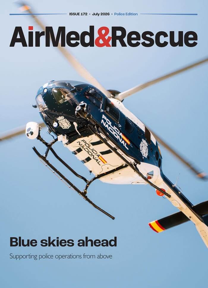
July 2026
Issue
As another July rolls around, it’s wonderful to bring you the airborne policing edition of AirMed&Rescue. We have features on the development and strategies used during aerial missing person searches; the active threats that affect aviation and law enforcement services particularly; the bread and butter of police aviation, the patrol and support operations; and the increasing use of drones as a force multiplier and sometimes as a first responder.
Mario Pierobon
Mario Pierobon is a safety management consultant and content producer. He writes extensively about aviation safety and has in-depth knowledge of the European aviation safety regulations on both fixed and rotary wing operations. His rotary wing expertise is concerned primarily with specialised operations and the operations requiring specific approval, such as HEMS, hoist operations and performance-based navigation.