

Hot pursuit: technologies for the chase

Amy Gallagher covers the chase with law enforcement pilots from around the world while highlighting the platforms, tools and technology that are critical during the mission
The human–machine interface is never more critical than during the seconds of the chase. While the ‘machine’ represents the aircraft, there is no doubt the catalyst for growth and development in technology, tools, and equipment has had a force multiplier effect on aerial law enforcement platforms throughout the world.
Globally, there are approximately 4,000 public safety helicopters, according to a 2024 research study conducted by Bell. The ‘Airborne Public Safety: Worth the Investment’ report highlights the transformative benefits of police helicopters on public safety operations, including faster response times, enhanced situational awareness, increased apprehensions, safer pursuits, and improved officer safety.
At the end of every shift, the goal of every decision within the collective aerial and ground law enforcement units is to “reduce the risk to the public and its officers, which is the primary purpose in every mission,” said California Highway Patrol (CHP) Chief Helicopter Pilot Scott Grant, who served as a military flight medic prior to his position.
For over half a century, the CHP air units have operated across the USA’s most populous state, from below sea level to the most remote mountains. Over 115 CHP crewmembers serve and protect air, land and sea, supported by eight strategically positioned law enforcement and rescue bases that represent the state’s more than 163,000 square miles.
“For rescues, the rural areas can be challenging, from below sea level to the high-density altitude over 16,000ft; our highest rescue was at 16,400ft,” said Grant. “Training our pilots supports the missions that are extensively required for altitude.”
The skills, tools and tactics of the crews, the modern mechanizations of aircraft platforms, and the integrated dynamics of technology can move as one system swiftly adapting between the extremes across the varied terrain of California, the towering redwoods and the vast cityscapes, night and day, within range of a 20-minute flight.
“Conducting missions throughout such a diverse landscape while navigating a population of 39 million, we have to be prepared to perform in all terrains and types of geography,” Grant said.
The CHP Air Operations utilizes 15 rotary- and 15 fixed-wing platforms to preserve life and assist ground control on and off the California highway.
“Our pilots and crews receive diverse training in order to conduct water rescues, medevacs, with a large quantity of law enforcement support and active pursuits,” he added.
Partnering to reduce fatalities
Reckless driving endangers the public, whether in a car or motorcycle, regardless of country, state or region.
“Our ground officers patrol to increase safety of the motoring public by reducing reckless motorists,” said Allen Blake, Supervisory Air Interdiction Agent at Air and Marine Operations (AMO). “Ground officers use the assistance of air patrols to identify reckless vehicles on the roadways, reduce crashes, increase safety of pursuits, and save lives.”
A case in point is the CHP aerial and ground law enforcement units in the Redding area.
“While gaining speed over 100mph, the ‘joyrider’ driving a motorcycle, we launched our rotor to get on top of it, [and] the target then accelerated to 160mph,” recalled Grant. “Knowing the suspect’s speed was too unsafe, we utilized our day camera that allowed us to maintain visual contact with the suspect. We then chose to have all ground crews back off the pursuit, as they turned off their lights and sirens.
“We hovered over the suspect until he exited the freeway when he attempted to hide behind a local business.
“As the suspect exited the motorcycle, we then redirected our ground units, whose officers arrested the suspect without incident,” said Grant. “The decision of this pursuit reduced the risk to the public and our officers, which is our primary purpose in every mission.”
Platforms and technology for diverse environments
According to Grant, the CHP rotary- and fixed-wing platforms are integrated with a variety of tools and technologies depending on the mission, including day and night infrared camera systems with compatible configurations with night vision goggles (NVG), multi-band radio with encrypted messaging, night elimination systems, stolen vehicle tracking devices, video downlink systems, rescue hoists, and equipment capable of performing air ambulance or paramedic procedures.
“We also have mapping systems that give direction to the physical address in latitude and longitude, providing the pilots with critical information to direct the course line while saving time and lives,” he explained. “In other pursuits, the day camera allows us to record who exits the vehicle and the position of the target relative to the vehicle.
We also have mapping systems that give direction to the physical address in latitude and longitude, providing the pilots with critical information to direct the course line while saving time and lives
“Night missions allow us to track suspects with or without a light source, by using our infrared camera and NVGs, which allow us to pick up a lot of movement,” said Grant.
“Aviation assets protect ground units by identifying threats before they become visible to road officers,” he added. “Working with road officers and aircraft platforms in tandem is an effective team solution to locate suspects on top of roofs or trees.”
Looking toward the future, Grant said the CHP is considering a variety of fixed-wing aircraft, both piston and turbine, but the technology may not necessarily be the same.
“Air assets are definitely a force multiplier,” he said. “For certain, one constant will remain consistent for a while: the helicopters.”
US Customs and Border Protection
AMO is a component of US Customs and Border Protection that operates aircraft and vessels. Its mission is to safeguard the nation by anticipating and confronting security threats through its aviation and maritime law enforcement expertise, innovative capabilities, and partnerships at the border and beyond.
According to Blake, AMO has four mission areas: air, maritime, and land law enforcement; domain awareness; contingency operations and national taskings; and extended order operations.
AMO has strategically placed 36 aviation locations across the USA to address varied operational demands. Units conducting aerial law enforcement patrols are based along both the northern and southern land borders, and in Puerto Rico.
Two examples: “The Tucson Air Branch covers the US–Mexico border in southern Arizona, supporting high-tempo border security and counter-smuggling operations in desert terrain, while the Great Lakes Air Branch conducts maritime and land interdiction missions along the northern border,” Blake explained. “This wide geographic distribution ensures rapid deployment of air assets to any location requiring aerial surveillance and enforcement.”
Mission-specific aircraft platforms
Every mission has its own needs that require specific aircraft platforms, including the H125 A-Star and the UH-60 Black Hawk.
“Crews operate from a fleet that includes UH-60 Black Hawk and H125 A-Star helicopters, as well as an array of seven different fixed-wing and UAS aircraft, each equipped with mission-specific sensors and communications,” explained Blake.
“Each aircraft platform has unique advantages tailored to mission profiles. The H125 A-Star helicopter offers excellent maneuverability and speed, making it well suited for urban and rural area pursuits. The A-Star’s relatively small footprint, strengthened with advanced avionics, creates reduced operational costs, including simplifying the maintenance process compared to larger platforms.
Each aircraft platform has unique advantages tailored to mission profiles. The H125 A-Star helicopter offers excellent maneuverability and speed, making it well suited for urban and rural area pursuits
“Pursuits fall under maritime and land law enforcement, involving pursuing and interdicting individuals attempting to evade law enforcement by using vehicles, fleeing on foot across challenging terrain, or vessels attempting to flee law enforcement in United States customs waters,” he said. “For example, AMO aircrews frequently collaborate in vehicle pursuits along the southern border, where suspects use remote desert roads to transport narcotics or illegal aliens.”
Blake detailed a recent mission when AMO agents from the El Paso Air Branch in Texas conducted an overwatch from an H125 A-Star helicopter when a human smuggler attempted to flee Border Patrol agents.
“The aircrew maintained visual of the vehicle and relayed direction of travel and situational awareness to ground agents,” he said. “Due to erratic driving of the suspect vehicle, the aircrew suggested the ground agents pull back from the Nissan Altima, advising they had a clear visual of the vehicle.”
Blake continued: “The aircrew watched the vehicle for nearly 30 minutes before the driver absconded on foot. He was arrested after the aircrew guided Border Patrol agents to where he was hiding.”
At the end of the chase, the driver, a US citizen, was charged with conspiracy to transport illegal aliens, he said.
“Later, a records check revealed the driver had a previous charge for shooting at or from a vehicle – a conspiracy resulting in death,” stated Blake.
Partnering with Border Patrol and state troopers
In another case from El Paso, Border Patrol agents and Texas state troopers requested air support after a vehicle loaded up with illegal aliens along the border wall, he said.
“A UH-60 Black Hawk aircrew spotted the target vehicle that was described by ground units as driving in a reckless manner, and who continued to evade law enforcement for about 15 minutes as the aircrew continued its active pursuit,” Blake explained.
“The aircrew relayed turn-by-turn directions to ground units until the vehicle stopped. The driver bailed out and began to run into the backyards of nearby residences, while the illegal aliens remained in the vehicle.
“The aircrew guided the troopers to the driver’s location, who was then arrested. The eight illegal aliens inside the vehicle were apprehended by US Border Patrol.”
Tools and technology to target and track
To pursue illegal immigrants and US citizens absconding arrest, AMO uses the H125 A-Star, which is uniquely equipped for law enforcement missions, with its high-definition electro-optical and infrared (EO/IR) camera, an advanced mapping system, a variable-beam searchlight, and downlink video capability.
“From the air, pilots can detect heat signatures through the EO/IR systems that provide thermal imagery, allowing detection,” said Blake. “Whether it is people on foot or from a vehicle’s hot engines hidden in brush, these cameras can detect movement in total darkness or through smoke and moderate cover.”
Whether it is people on foot or from a vehicle’s hot engines hidden in brush, these cameras can detect movement in total darkness or through smoke and moderate cover
Alongside imaging technology, moving map software with real-time data that integrates sensor feeds with GPS coordinates allows pilots and tactical flight officers to provide precise situational awareness to ground units, he added.
“Aerial searchlights with variable-beam settings can illuminate suspects or aid in searches, while encrypted radios connect aircrews directly with CBP, and other federal, state, or local law enforcement partners,” he said. “This combination of equipment and expertise ensures targets are tracked continuously, with minimal opportunity to escape observation.”

Operational flexibility and smooth transitions
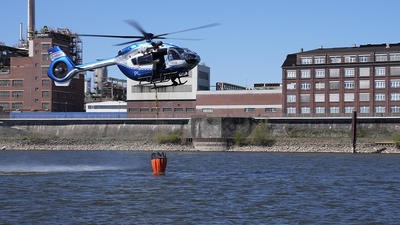
OPENSIGHT’s high operational flexibility provides transitions between transportation modes and geographic environments with a platform that supports dynamic sensor switching, which allows aerial law enforcement officers to alternate between different video streams and sensors (including EO/IR and thermal cameras) in real time.
“Additionally, its AI inference engines can quickly redirect to focus on new targets, whether they are on foot in urban settings or in vehicles in rural zones,” said Mattia Carpin, Head of Engineering at FlySight.
Geography and terrain create a significant impact on the dynamics of aerial law enforcement pursuits, he said. “[OPENSIGHT] is specifically designed to overcome these challenges by enhancing visibility and target identification, even in densely urban environments, heavy vegetation, or low-visibility zones.”
Geography and terrain create a significant impact on the dynamics of aerial law enforcement pursuits
This direct feedback loop ensures that the system evolves in response to real-world needs, allowing its capabilities and technologies to be continuously refined and customized, he added.
The system’s modular design also allows seamless integration with airborne assets, drone-based sensors, and handheld ground units, which provides full-spectrum surveillance without losing continuity or precision during transitions.
“Its AI-enabled Automatic Target Recognition (ATR) capabilities help differentiate relevant targets from background noise, while the augmented reality (AR) overlay delivers critical topographic and cartographic data, such as real-time obstacle alerts, during flight,” said Carpin.
This becomes especially important in transitional zones between urban and rural areas, where the environment shifts rapidly and demands adaptive, high-precision surveillance tools. “OPENSIGHT’s geo-referenced detection and dynamic neural network switching allow operators to maintain high accuracy, even in the most complex terrain,” he explained.
Benefits and future upgrades
OPENSIGHT is built with cost-efficiency and ease of integration in mind. It is platform agnostic and compatible with a wide variety of aircraft – including rotary-wing aircraft, uncrewed aerial vehicles (UAVs), and fixed-wing platforms – with minimal modifications needed. The software is lightweight, requires low power consumption, and can operate on compact AI computing modules.
“We are continually advancing OPENSIGHT’s capabilities by incorporating emerging technologies, particularly in the fields of machine learning, neural network optimization, and sensor fusion,” said Carpin.
Future upgrades aim to improve autonomy, real-time decision support, and AR features, including more immersive 3D mapping and predictive analytics, a wide range of system configurations, hardware platforms, and sensor suites. This ensures smooth integration and optimal performance across diverse mission scenarios. Moreover, the open architecture supports the easy incorporation of third-party sensors and AI models, allowing the system to evolve alongside technological advancements without requiring a full platform replacement.
Geography and terrain
The mission’s location relative to its geography and terrain often creates visual obstacles. Conversely, urban areas also bring opportunities to apply specific technological systems.
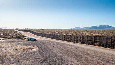
“Geography is often one of the greatest challenges in aerial law enforcement,” said Blake. “In the southwest, such as west Texas, Arizona and New Mexico, vast deserts and rugged mountain ranges can quickly obscure vehicles and foot traffic, and these terrain features can complicate line of sight for both aircrews and ground teams.”
Vast deserts and rugged mountain ranges can quickly obscure vehicles and foot traffic, and these terrain features can complicate line of sight for both aircrews and ground teams
AMO agents use expert knowledge of their respective areas of operation to answer these challenges, while urban environments present a different set of difficulties.
“In dense neighborhoods or industrial complexes, suspects can exploit structures and narrow alleys to break visual contact,” said Blake. “To counter this, AMO aircrews rely heavily on thermal cameras and augmented mapping tools, which help track movement beyond obstacles. The combination of sensor versatility and experienced operators allows AMO to adapt to these terrain-based challenges.”
Flexible transitions from vehicle to foot
“When a pursuit transitions from vehicle to foot, the aircrew switches tactics immediately, as the crew will position the aircraft and the sensors to maximize the ability to find the suspect,” explained Blake. “In rural areas, thermal contrast is often higher, making it easier to distinguish a person from surrounding terrain. In an urban environment, the crew may rely on a combination of thermal and high-definition cameras to maintain continuous observation.
“Mapping overlays and geopoint markers can provide the exact locations for responding agents/officers,” he said. “If the suspect attempts to hide inside a structure, the aircrew relays the last known positions and coordinates perimeter security until ground teams can confirm apprehension. This flexibility is one of the reasons air support is so effective in dynamic pursuits.”
This flexibility is one of the reasons air support is so effective in dynamic pursuits
Aircraft as a platform for technology
Stéphane Rousseau joined Airbus as Head of Operational Marketing five years ago as a former rotor pilot serving in France’s Gendarmerie nationale. Rousseau has flown several units and 10 types of aircraft platforms, primarily the EC145, serving rescue and SWAT missions.
“As a helicopter pilot, when it comes to serving a police mission, the aircraft is just a platform that we must be sure is safe, fast and reliable,” he said. “Our aerial law enforcement configurations serve a range
of customers with sensor technology and communications.”
Rousseau explained that the primary purpose of the advanced technology was “to save and protect our citizens, as well as protecting our pilots, which is key”.
Features like forward-looking infrared (FLIR) camera, powerful searchlights, and night vision capability strengthened the multi-use platforms’ overall operational capabilities, he added.
‘Next-generation’ police missions: speed and safety
Airbus Helicopters has developed a new Law Enforcement Mission System for its H145 light twin, which includes a foldable mission operator station, a mission system with artificial intelligence (AI), a next-generation hoist, and illuminated blade tips.
“The blade tip illumination will help enhance situational awareness for pilots when near obstacles,” Rousseau explained.
Full scope of the mission: reconfigurations in minutes
“Pilots and crew never know what’s ahead of them,” said Rousseau. “They may take off for a typical police mission or to provide a rescue mission or perform a SWAT team mission at night.”
In an ideal world, you’d have one aircraft per mission, said Rousseau. “It’s in our abilities to have all of our aircraft able to reconfigure for the specific mission in 20–30 minutes, switching from one mission type to another,” he said.
It’s in our abilities to have all of our aircraft able to reconfigure for the specific mission in 20–30 minutes, switching from one mission type to another
When it comes to chases, Rousseau said, it’s the camera system that is the heart of the mission. “Just imagine performing a chase at night, even with NVGs, if you don’t have a camera to help you follow the target from the car on foot.”
Autopilot control also helps to reduce the workload during those critical phases, he added. “As a former French army pilot, I feel the police forces are very proud of the new system.”

Western Australia: daily ‘evades’
In Western Australia, assisting in police chases are a common occurrence for the Police Air Wing, said Superintendent and Officer in Charge Paul Daly. The Wing’s main operations are in Jandakot, Western Australia, with a second based at Karratha, which houses a PC-12 transporter serving the state’s northwestern region.
The WA Police Air Wing also operates two five-bladed H145s, serving primarily land and sea search and rescue capabilities, while aerial law enforcement represents their day-to-day activity, he added.
“We engage in ‘evades’ (chases) regularly,” said Daly. “Our role could be providing situational awareness as part of an evade police incident, providing top cover at a search warrant entry or monitoring the highways and freeways for speeding motorists.
“The time I recall was a violent offender who was armed and fired rounds at us, refusing to stop for the police,” he added. “The helicopter and crew did an excellent job to keep eyes on him at a safe distance and enabled our tactical team to resolve the incident.”
A Police Air Wing uses a combination of resources depending on location and duration. Generally, helicopters are more maneuverable and perform better at low altitudes, albeit with limited duration,
said Daly, while “fixed-wing aircraft are better for longer evades”. Crews are tasked with searching forest, rural, desert, marine, and urban environments while utilizing all assets as tools for various missions, he said.
“An officer will call us with a particular mission and we will match an aircraft accordingly. Some require distance and duration; others are short and discreet that you may use a drone for. Due to the variety of police work, there is not a single aircraft that can do everything.
An officer will call us with a particular mission and we will match an aircraft accordingly
“For precise target identification and location, we use the SAFIRE 380-HD X FLIR, which is able to be streamed to officers and command teams on the ground via our Silvus mesh network,” he explained.
When a target transitions from vehicle to foot, “the FLIR is the primary weapon here”, Daly said. “With infrared heat sensors, there is virtually nowhere we cannot track a person and direct ground units to their location. Multiple targets are challenging; however, the team are experts in rounding up every one of them.”
A solid cordon and patience generally see results follow, Daly added.
Rapid deployment, future forward
“In the future, we are adding a PC-24 jet into our fleet to assist in rapid deployment across the state,” Daly said. “Being the largest policing jurisdiction in the world presents significant challenges in getting specialist resources to locations, and this will greatly improve response times.
“We are also investing in drones, which are a much cheaper option and deliver a very good outcome for the operations of short duration and localized area,” he added. “Civil Aviation Safety Authority (CASA) regulations restrict our area of operations at the moment to visual line of sight. Once beyond visual line of sight approvals are provided, this will significantly enhance our capability.”
Larger drones are also a strong consideration due to their cost and flight duration, said Daly. “Being able to engage this type of drone will significantly enhance the safety of our officers and the public and the way we operate.”
October 2025
Issue
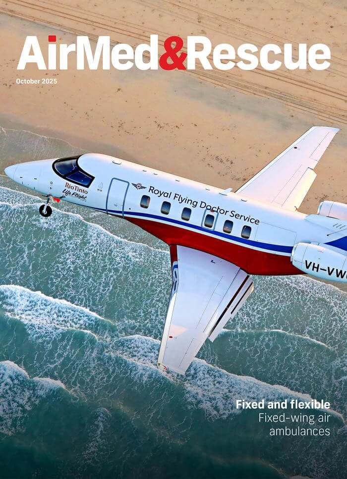
In our October edition, we bring you news, features and more showcasing special missions from around the world. We have features that focus on the fixed-wing air ambulance platforms that are enhancing air medical operations; the care and considerations when transporting children with infectious diseases at risk of deterioration; the law enforcement agencies that use aircraft to find and track persons of interest; and the challenges of treating patients with hyper- and hypothermia.
Amy Gallagher
Amy Gallagher is an internationally published journalist covering aviation, rescue, medical and military military topics, including training and technology, as well as evidence-based research articles. As a journalist by education and certified English instructor, Amy has worked in both agency and corporate communications, providing educational and promotional writing and training services.