
Fire intelligence aircraft: eyes in the sky that never blink

Barry D Smith explores how the aerial firefighting sector is adapting its processes to incorporate better sensor technology and increase the value gained from the data available
With the frequency and intensity of wildfires in the past 20 years, it is more important than ever to detect and aggressively attack fires as early as possible. In order to use firefighting resources effectively and efficiently, incident commanders must know how intense the flames are, where they are located, and where they are going. This has led to an increasingly critical role for fire intelligence aircraft that can see the fire, map it, and provide information on how it is spreading. Even more important is the ability to quickly deliver this data to the firefighters on the ground.
An all-hazards platform
The state of Oregon in the USA has just placed into service a De Havilland Twin Otter that is one of the most advanced fire intelligence aircraft in the world.
“We had used a Partenavia P.68 twin-engine aircraft as a fire intel ship for over 40 years,” explained Neal Laugle, Oregon Department of Forestry (ODF) State Aviation Manager. “We wanted to get a new aircraft due to the age of the airframe, the fact that the sensors were older technology and we had maxed out the payload so we couldn’t add any more weight.
“We decided on the Twin Otter because we were looking at using the next aircraft for more than just fire detection. We wanted an all-hazards platform that could deliver personnel anywhere in the state quickly, and deliver cargo into short, unimproved air strips because of its good short takeoff and landing (STOL) capabilities. We have found it is very stable in a low-speed orbit over a fire and has a good amount of loiter time. The payload of the Twin Otter allows us to install more sensors and allow for future growth.”
A standard crew for a fire mission at night is two pilots, both using night vision goggles (NVGs), and one or two sensor operators depending on which sensors will be used. Another benefit of having the Twin Otter is that they can train new sensor operators on missions. The P.68 didn’t have the room and payload to carry trainees. ODF flies both day and night missions, but during the summer most are flown at night to patrol areas where thunderstorms have been active. They will fly behind the storms and search for fires.
the sensor sees with the information needed to understand the wider situation and make informed decisions,” concluded Carpin.
Knowing where people are during a fire incident is also as important as knowing where the fires are. It’s essential to make sure that people aren’t at risk of being caught in a fire as well as being safe from the firefighting activities, said Andrew Munro, Managing Director, Smith Myers: “ARTEMIS allows aerial firefighting crews to detect and locate people through their mobile phones, including when smoke, cloud, terrain, or darkness limits visibility. The system can geolocate multiple devices across an operational area. Known firefighter devices can be distinguished from others, helping crews track responders and identify civilians who may remain at risk.
“Before a water drop, crews can geofence a proposed drop zone to identify devices within or nearby. This provides another indication of whether people may be present, alongside visual observations and radio reports.
“ARTEMIS also supports SMS, voice, and Emergency Warning System communications. Device locations can be integrated into mission management systems and used to cue sensors such as electro-optical/infrared (EO/IR). This gives crews an additional source of information for locating people, assessing drop zones and communicating with those on the ground, supporting safer and more informed operational decisions.”
One-stop fire intelligence aircraft
The ODF P.68 was one of the first fire intel aircraft to install Starlink satellite internet for downloading images and data to incident commanders and ground units. They had Starlink installed on the Twin Otter and that will be their primary downlink device. This gives near real-time data sharing.
Patrol flights after thunderstorms play an important role in detecting fires early. Before the flight, the location of ground lightning strikes is uploaded into the aircraft. The crew can then fly from point to point to detect new fires before they have a chance to grow.
Sensor manufacturers are now beginning to develop packages for one-stop fire intelligence aircraft. Trakka Systems has been involved with IR/electro-optical camera systems as well as augmented reality mapping systems for law enforcement for many years.
“Fire intelligence is a market space I think a lot of other vendors miss out on,” explained Mike Kipphorn, Trakka’s Sales Director for the Western USA. “Some of the larger companies don’t see it as a huge growth market. With the increase in the size and frequency of destructive fires, Trakka sees an opportunity to help pilots, aircrews, and incident commanders with something they haven’t had before: a clear, real-time picture of what the fire is doing. We believe that Trakka has the right equipment to get the job done.
“Having spent time with customers, real-time fire intelligence gathering seems to be making a pretty big difference in controlling fires,” he added. “If you can’t prevent fires, the next best thing is to be able to fight it effectively. You can’t fight it effectively unless you know exactly where it is, what is its intensity, and where is it going.
“We offer several tools for gathering intelligence. We have our gimbaled camera systems, which house multiple sensors. Depending on the customer’s needs, we can install long-wave, mid-wave, and short-wave IR sensors. The mid-wave camera can see fires from a longer distance at higher altitudes, which allows for early detection. The short-wave IR has the ability to penetrate smoke and see what the fire is doing and what direction it is going. There are also daytime cameras available.
“We also have a mapping system that is tied into the camera systems so we can plot the location of the fire, where the hottest areas are, and where any spot fires have started outside the fire perimeter. This creates a map in real time with coordinates that can be sent to the ground crews. This makes it much safer for the ground crews as the maps can show if any of them are in danger of being overrun by the fire.
“We currently have two different camera systems being used in wildfires, the TC-300 and the TC-375. They are very similar in sensor payloads, with the main difference being the camera optics. The TC-300 is used at altitudes up to 15,000ft to get an overall picture of the fire. For the ability to zoom in closely, the TC-375 is a better system. We have a variant of the TC-375 called the 375 QUAD, which allows installation of other sensors such as radiometric cameras that use IR to determine the temperature of the objects you are looking at.”
In changing and crowded environments, too much information can be overwhelming, so a system that can help crews focus on what matters can reduce workload and improve mission effectiveness, explained Carpin: “In a complex operational environment, the challenge is often not a lack of information, but having too much information available at the same time. From our perspective, a good mission system should help the operator manage that complexity. OPENSIGHT allows different information layers and mission objects to be displayed and managed within the same operational environment. Operators can work with tracks, points of interest, sensor information, and geospatial data, while using the map and video views together to focus on the information that is relevant to the mission.
“The system also provides image-processing tools that can help operators adapt live video to the conditions they are working in, including contrast and gamma adjustment, false-color processing, histogram equalization, and dehazing. Region-of-interest enhancement can also be used to bring additional detail to a specific area of the image. We are also integrating AI-based detection and classification capabilities. These can help identify predefined targets in live video and provide their geographic context.” Carpin added: “Ultimately, the technology should not give the crew more information simply for the sake of it. It should help them identify what is relevant, put it into context and reduce the amount of information they need to process manually.”
Using geofencing, operators can define areas of concern such as a fire front, evacuation zone, drop zone, or other hazard and focus on mobile devices within them. Integrated with a mission management system, this information can be combined with fire mapping, EO/IR, radar, and responder positions to provide a clearer operational picture
Munro agreed that it is important to have the right amount of information in the right way, and being able to act on the intelligence gathered: “In a modern emergency, the challenge is not a lack of information but identifying what matters most at that moment. ARTEMIS is designed to deliver actionable information rather than simply adding another data stream. Using geofencing, operators can define areas of concern such as a fire front, evacuation zone, drop zone, or other hazard and focus on mobile devices within them. Integrated with a mission management system, this information can be combined with fire mapping, EO/IR, radar, and responder positions to provide a clearer operational picture.
“ARTEMIS can also help reach people identified within areas at risk. Its Emergency Warning System can rapidly broadcast evacuation instructions, warnings, or muster-point information, while direct SMS and voice capabilities enable more targeted communication.
“This changes the aircraft’s role. Rather than simply observing an emergency from above, it becomes an active tool for understanding the situation, communicating with those affected and helping manage the response.”

Fire intelligence Down Under
Several states in Australia operate very sophisticated fire intelligence platforms. Jayson McKellar, Director of Aviation for the NSW Rural Fire Service (RFS), described the New South Wales intel aircraft. “We currently own two Cessna Citation V jets and one Beechcraft King Air turboprop for the fire intelligence role. The Citation has been in production for some time and is a very reliable aircraft. Its payload capability is good and can fit all the sensors. It can also fill the air attack role directing aircraft over a fire, as well as act as a lead aircraft for our fast jet Boeing 737 airtanker. The territory is very large, so the speed of the Citation is an asset in reaching fires anywhere in New South Wales quickly. We can also support surrounding states and territories with the intel aircraft if we are able. Its slow-speed characteristics are also very good for loitering over a fire.
“Coulson Aviation, located in British Columbia, Canada, developed and installed our sensor suite for the intel aircraft. They provide the pilots and maintenance for the aircraft and helicopters on a contractual basis. The RFS provides the sensor operators. We basically knew what kind of sensors we wanted to install and worked with Coulson and different sensor manufacturers to make the final decision and then worked with the aviation regulators here in Australia to get the equipment installed.
“One of the main sensors on all of our intel aircraft is the Overwatch Imaging TK-9 IR sensor, which has multispectral IR capabilities. The common operating picture (COP) receives the data from the aircraft which can then be accessed by the incident command team. The COP is a centralized digital mapping and intelligence platform that integrates live satellite data, fire scanners, data from the intelligence aircraft, and field intelligence into a single interface that can be accessed by fire managers. We are also looking at lidar (light detection and ranging) systems that could tell us information on fuel density and moisture. The system uses pulsed lasers to measure distances and create highly accurate, three-dimensional representations of objects and environments. We are not there yet, but it is certainly one of our goals for the future.”
The RFS uses both 5G cellular technology and Starlink satellite connectivity to download maps and images to the ground units and command structure. With so much of their response area being very remote, these cellular capabilities are very important for quick dissemination of data. With the large amount of data they can collect, McKellar said the Starlink had been a game-changer for them, especially when working on multiple fires in one day.
One of the advantages of the Citation is that it can be used as a lead aircraft for the 737 or other airtankers and then make an IR scanning pass after the drop to gauge its effectiveness. This allows the next drops to be adjusted to make them as productive as possible.
“Fire intel aircraft are having a big impact on bushfire fighting in NSW and will only improve with time and additional technology,” McKellar commented. “It is a game-changer which allows the rapid gathering and sharing of critical information and images. We continue to look at new technology and learn how to better use what we have.”
It is a game-changer which allows the rapid gathering and sharing of critical information and images. We continue to look at new technology and learn how to better use what we have
In the state of Victoria, bushfire responsibilities lie with the Department of Energy, Environment and Climate Action (DEECA).
“For the 2025–26 bushfire season, we have three [Airborne Intelligence] Gathering (AIG) platforms: two Airbus AS350 B2/B3 and one EC135 which use the call sign Firebird,” explained DEECA Senior Aviation Operations Officer Mark Urquhart. “One is always on call, crewed by a pilot, a camera operator, and a mapping officer. A second one is available on high fire weather days. We also have another Firebird, which functions as an air attack supervisor (AAS) platform for our night firebombing program that is crewed by a pilot, air attack supervisor, and a camera/mapping operator. In addition, Victoria has two dedicated Overwatch Pilatus PC-12 fixed-wing aircraft with the call sign of FireScan for large-area imagery of fires.
“In addition to these dedicated aircraft, all contract air attack and air observer platforms have dedicated aviation tablets for real-time mapping and image capture. Several aircraft also have livestream video capabilities. We continue to install more cameras on aircraft.”
The AIG, or Firebird, helicopters use the WESCAM MX-10 IR/camera system, which provides real-time video imagery and mapping capability that is streamed directly to a web platform that can be accessed by all Victoria agencies. This provides situational awareness and detailed mapping of the fire edge in both IR and color imagery.
The transmission of information to support decision making needs to be in a way that is suited to all relevant personnel, from operators on the aircraft to the incident commanders in a remote location, said Carpin: “For us, the first step is making sure that data can be integrated and managed in a structured way. OPENSIGHT can receive multiple video sources and different types of mission data, bringing them together within the same operational environment. The system also supports video restreaming to remote endpoints, while mission data can be exchanged between multiple OPENSIGHT consoles. This means that relevant information can be shared across the mission team rather than remaining isolated on a single platform.
“Just as importantly, the information needs to be easy to understand. OPENSIGHT combines live sensor video with a geospatial view and provides tools such as tactical overlays, target designation, sensor cueing and standardized symbology. This gives commanders and operators a common operational picture rather than simply providing them with a raw stream of sensor data. The system also records mission information, including platform telemetry, metadata, operator interactions, target designation and sensor cueing events. This creates a structured mission archive that can be used afterwards for replay, analysis and debriefing.” Carpin continued: “Ultimately, our focus is on making information available in the right format and context, so that it can move from the sensor to the wider mission team and support decisions when time is critical.”
The system also records mission information, including platform telemetry, metadata, operator interactions, target designation and sensor cueing events. This creates a structured mission archive that can be used afterwards for replay, analysis and debriefing
Remote or rural areas with limited communications services, or places with damaged infrastructure can pose challenges for incident command and communication, so having tools that can work independently is a boon in any firefighting exercise, said Munro: “Major emergencies can disrupt power, cellular networks, and terrestrial communications just when reliable information is most important. ARTEMIS provides an independent airborne capability that does not rely on local cellular infrastructure to detect, locate, or communicate with mobile phones. If networks fail, it can provide temporary cellular coverage from the aircraft, helping crews locate and contact people directly.
“Information is generated where it is needed, reducing reliance on external processing and communication. As automation and AI-assisted interpretation develop, they can further reduce operator workload by filtering information and highlighting what requires attention. The aim is to support, rather than replace, operator judgment.”

Seeing through the smoke
The Overwatch systems carried on the PC-12 aircraft are Overwatch Imaging model TK-8 IR scanners. These can produce visual color, near IR, short-wave IR, medium-wave IR, and long-wave IR images. Each of the different IR wavelengths produces a slightly different image of a fire. Some are good at spotting very small spot fires. Others are better at seeing through the smoke to the fire underneath. The images are taken at altitude so the aircraft does not interfere with ongoing water and retardant drops. Initial quick print products can be sent from the aircraft within minutes on completion of a scanning pass. Imagery is directly transferred to agency systems and viewable as overlays on all agency mapping systems.
The fixed cameras on the AAS platforms provide real-time video streaming that provides situational awareness to the incident management teams and the State Control Centre. The aviation tablets enable air attack supervisors and air observers to provide real-time mapping updates and image captures, which feed directly into the all-agency mapping systems.
“The State Air Desk coordinates and prioritizes the assignment of the intelligence aircraft through consultation with the state response coordinator,” Urquhart said. “The Overwatch aircraft may capture multiple scans of multiple fires in one day. This year, during a period of four simultaneous large fires, the Overwatch ships completed circuits of Victoria, capturing each fire every three to four hours.
“Managing data is a complex undertaking. We need to balance image quality with file size for timely transmission. While the Overwatch system can produce quick print products, the files with greater detail are normally uploaded to servers once the aircraft has landed at its base. We are constantly looking at technology that will allow more detailed files to be downloaded quicker and pushed out to the end users on the ground. We are also making significant investments in new technology such as AI and drones to further strengthen our capacity to manage and utilize data effectively.
The most significant benefit from this information is the enhanced situational awareness it provides across multiple levels of emergency response. For operations personnel working on the ground, receiving real-time images or updated maps directly from the air attack supervisor via tablets enable them to make informed decisions quickly and efficiently
“The most significant benefit from this information is the enhanced situational awareness it provides across multiple levels of emergency response. For operations personnel working on the ground, receiving real-time images or updated maps directly from the air attack supervisor via tablets enable them to make informed decisions quickly and efficiently. Incident management teams utilize these mapping products and data to develop strategies, allocate resources effectively, and manage communications. Meanwhile, the State Control Centre leverages this information to gain a comprehensive overview which supports the prioritization of resources statewide.”
As the technology available to aerial firefighters continues to evolve, so too will the capabilities and proficiencies of the missions. Carpin explained where he sees development heading and what this means for firefighting: “I think we will see a continued move towards more connected and intelligent systems. There will be more sensors, more data and increasingly sophisticated ways of processing that information. The challenge will be making sure that this does not translate into more complexity for the operator.
“Data fusion, geospatial contextualization, and AI-assisted analysis can help address this. Instead of simply providing separate streams of information, the system can combine them and provide a more meaningful operational picture. At FlySight, we see the mission system as the layer that brings these technologies together. Our focus is on making different sources of information work together and turning them into something that is useful to the people actually operating the mission. I believe that is where the real value of technology lies: not in providing more information, but in helping crews understand the situation faster and make better-informed decisions,” he concluded.
Munro sees a future where the entire firefighting operation is more interconnected: “We see the technology moving closer to the point of action and becoming more distributed across the firefighting response. One trend is deployment on delivery aircraft. A water bomber operating independently, for example, could use ARTEMIS to help confirm whether people are present in or near a proposed drop zone before releasing its load.
“Uncrewed aircraft are another important development. Equipped with ARTEMIS, uncrewed aerial vehicles (UAVs) could search for and locate mobile phones and potentially communicate with people, enabling persistent searches ahead of a fire front or in areas too hazardous for crewed aircraft. The capability is also moving onto the ground through ARTEMIS-Flex, supporting teams operating from vehicles or temporary locations.
“Ultimately, we see command aircraft, water bombers, helicopters, UAVs, and ground teams contributing to a shared picture. ARTEMIS complements existing sensors by adding the human layer: helping responders understand where people are as an incident develops.”
October 2026
Issue
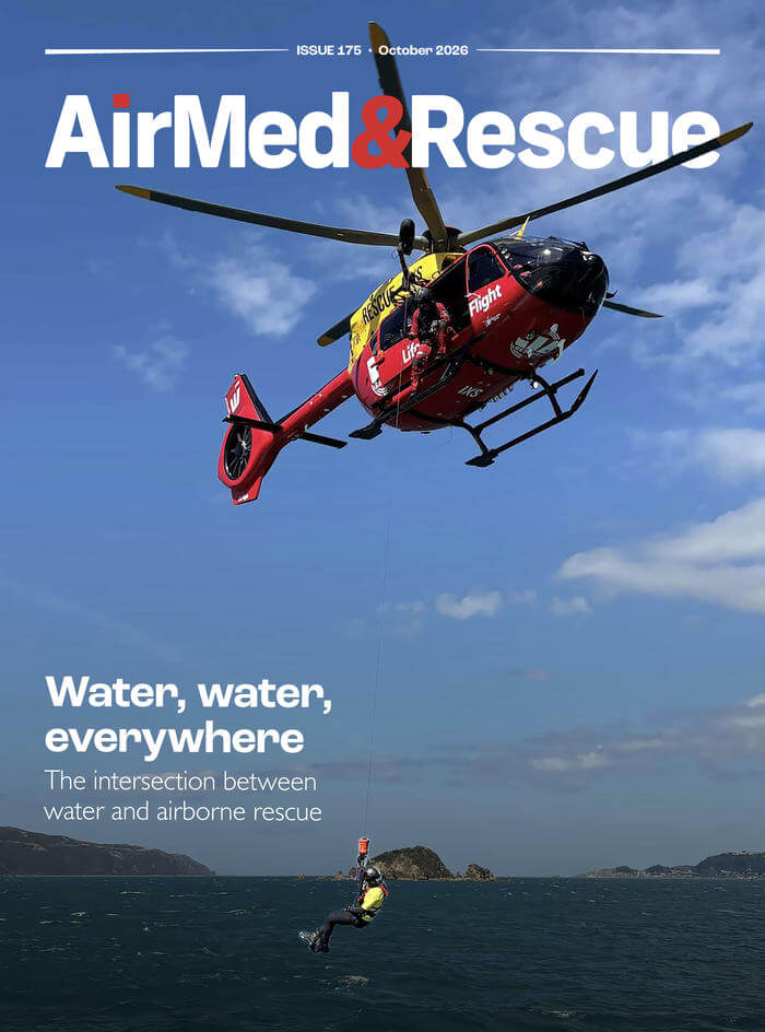
The latest edition of AirMed&Rescue is packed full of content to keep you occupied in October. We have features on the challenges that swiftwater presents when trying to rescue someone; how sensor technology is affecting and improving aerial firefighting missions; why operators choose to have a varied fleet of aircraft to perform special missions; and what can be done to improve the accessibility and awareness of mental health assistance programs for safer and sustainable working conditions.
Barry D Smith
Barry Smith has been an aviation and emergency services writer/photographer for over thirty years. He has published over 250 magazine articles and six books. He has also worked in emergency services as a paramedic, volunteer firefighter, and member of search and rescue teams for over 40 years.