

Getting ahead of wildfires: becoming proactive as opposed to reactive

Proactive approaches for fire management are making a difference to wildfire response and success. Barry D Smith speaks to the people who are engaging in fighting wildfires using a prognostic perspective
For decades, organizations fighting wildfires have taken a reactive approach. The guiding principle in many areas of the world has been to use an aggressive initial attack plan to keep wildfires small. Unfortunately, that is not enough today. Climate change has caused extreme droughts, high winds, and high temperatures. Scientists are finding that the damage from wildfires goes far beyond the homes lost and forests and grasslands burned. Healthcare researchers are beginning to study the effects of wildfire smoke, which can drift hundreds of miles. One study suggests that particulates in wildfire smoke contribute to the death of as many as 24,000 people each year in the USA.
With the high cost of wildfires to society only increasing, universities, government agencies, and private companies are turning to proactive strategies to mitigate wildfires. But in order to be proactive, they need data to accurately predict wildfire risk assessment and behavior. And that data needs artificial intelligence (AI) and supercomputers to create behavior models that can be used in near real time.
One of the first programs to put all these separate pieces of the puzzle together is the WIFIRE program coordinated by the University of California San Diego (UCSD). Mel Ceccanti is currently Vice President of Flight Operations for Coulson Aviation of Thermal, California. In 2019, he was one of the pilots of a helitanker under contract to the Southern California Edison (SCE) power company for dedicated day and night firefighting under a program called the Quick Reaction Force (QRF).
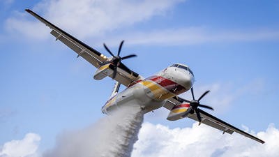
“On September 24 2019, we were dispatched at 03:44 hrs for a brush fire,” related Ceccanti. “Fire upon arrival was 0.5 to 1.0 acres in size. In addition to the helitankers, the QRF includes a Sikorsky S-76 as a helicopter coordinator and intelligence ship. It is equipped with electro-optical and infrared cameras. The data from our S-76 was sent to the Fire Integrated Real-Time Intelligence System (FIRIS) aircraft orbiting the fire above the fire. (The FIRIS program is currently being run by the California Office of Emergency Services.)
“The data gathered by both aircraft was relayed to the UCSD WIFIRE lab, which created a computer model of the fire behavior based on time, location, ignition source, acre size, population affected, and housing affected. When the fire was determined to be contained and the aircraft were released, fire had covered 1.5 acres. The environmental factors were a wind speed average of 40mph out of the northeast, temperature was 74°F. Fuel moisture was just 3% with a relative humidity of 7%. So, it was a Santa Ana wind event with long-range firebrand production ahead of the fire. There was a potential for very large fire growth in a short time. If the fire had not been fought at night by these resources, by 05:00 hrs the fire was predicted to go to 593 acres, affecting 4,100 people and 1,500 homes. By 06:00 hrs, the forecast was for 1,100 acres, affecting 8,500 people and 3,200 residences. By 07:00 hrs, it was forecast to be 2,200 acres, affecting 11,400 people and 4,100 homes.
Without night aerial firefighting resources, this would have been a major fire instead of a small incident affecting less than two acres of land
“By 07:30 hrs, when you would expect daytime air resources to be responding, the forecast was for the fire to be 2,500 acres in size, affecting almost 16,000 people and over 5,400 homes,” Ceccanti continued. “This shows without night aerial firefighting resources, this would have been a major fire instead of a small incident affecting less than two acres of land. The total cost of the aircraft that responded to the fire during the night was US$27,000. If the aerial firefight had waited until daylight, the normal initial request for aircraft to begin fighting a fire of the size it would have grown to would have been $391,000 for six hours of flight time on the helicopters, airtankers, and aerial supervision aircraft.”
Fire behavior modeling
SCE wants to know if the contract money (almost $27 million) is being well spent. Therefore, it has asked for a cost-benefit analysis at the end of the season. One of the roles of the S-76 is to gather data that can be analyzed by the WIFIRE program to develop reports on what would have happened without the use of the night firefighting assets and what would be the effects on the local communities. The fire plots are also sent to the UCSD WIFIRE program so they can develop models of fire behavior to be used by the incident commanders to help them plan their overall attack on the fire as well as predict where evacuations of the population will need to take place. As the fire is suppressed, new behavior models are created using the data from the S-76. This allows regular updates to be produced.
The WIFIRE predictive software is called Firemap. It integrates data from the airborne intelligence aircraft, over 400 weather stations in southern California, and ground sensors, as well as satellite imagery and historical fire data. It can deliver predictive maps within minutes of the start of a wildfire. This kind of information is not only valuable for predicting the spread of the fire, but is crucial for developing fire attack and evacuation planning for urban wildland fires such as occur in southern California.
Private companies are also beginning to offer AI and computer-enhanced predictive wildfire behavior models to firefighting agencies around the world. FiSci of Sydney, Australia, has developed a software program called Mitigate, with predictive modeling of future fires as well as programs to predict where a wildfire will go once it starts.
Our goal is to continually and responsively create software to provide anyone concerned with wildfire risk with the toolkit they need to reduce risk through predictive AI modeling and real-time mitigation strategies
“Our goal is to continually and responsively create software to provide anyone concerned with wildfire risk with the toolkit they need to reduce risk through predictive AI modeling and real-time mitigation strategies,” explained Gregory Vigneaux, Technical Account Executive with FiSci. “We examine such data as weather, vegetation type, vegetation load, terrain, fire history, and points of origin to determine future potential fires. Once a fire does start, we can model the path of the fire using all the data gathered. Our weather forecasting extends 14 days beyond the present, supporting two weeks of fully predictive analytics.”

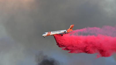
FiSci uses several methods to verify the accuracy of their predictive models. Customers can upload their own data to ensure critical variables are as accurate as possible. All data within the tool can be edited and fine-tuned by the customer to reflect local conditions. FiSci encourages customers to physically assess the fire aftermath to verify the fire’s behavior and compare it to the predicted behavior. Finally, historical case studies can be performed by entering the exact behavior of an actual fire to see if the simulated spread of the fire matches the actual events that took place.
“In addition to standard data sets, our Mitigate program offers the ability to ingest lidar data,” commented Vigneaux. Lidar is a remote sensing technology that uses laser pulses to measure distances, creating a precise 3D, high-resolution model. “This allows the program to capture high-resolution canopy-height and vertically stratified fuel data differentiating between ground, understory, and canopy fuels. This allows the simulation engine to model fire behavior with much higher physical realism.”
Locating dip sites
Perhaps no country on Earth experiences a more extreme climate than Australia. Droughts can last for years, with summer temperatures reaching 50°C (122°F). Surface water disappears and vegetation is easily ignited to create massive bushfires. Very wet winters create flooding and spur vegetation growth to fuel fires the following summer. These floods can also refill water bodies throughout the country.
For firefighting helicopters, these extremes of dry and wet can be very frustrating when trying to locate reliable dip sites to fill buckets and tanks. Even if they do locate good sites, they may dry up as the summer progresses.
Emergency managers told us they needed clearer, faster access to information about where water is and how recently it had been observed, for preparedness and pre-season planning
“Emergency managers told us they needed clearer, faster access to information about where water is and how recently it had been observed, for preparedness and pre-season planning,” explained Pip Martens, Media Adviser for Geoscience Australia. “Natural Hazards Research Australia, Geoscience Australia, and FrontierSI worked with the National Aerial Firefighting Centre, the New South Wales Rural Fire Service, and Victoria’s Country Fire Authority to create a database to meet the needs of firefighting helicopters in identifying potential water sources. The Digital Earth Australia (DEA) Waterbodies database was updated in 2024 to address the changes requested by these emergency managers.
“In addition to identifying aircraft-accessible water bodies, one of the goals of the project was [to] contribute to aircraft selection and allocation based on access to water,” Martens continued. “If no adequate water sources could be found in a certain area, it would be pointless to base helicopters in that region. Fixed-wing aircraft able to load water or retardant at an airport would be more appropriate. Helicopters could then be assigned to areas with sufficient water bodies to be effective.”
The project focused on making key planning information, such as when water was observed and an estimate of surface area, more directly accessible alongside each mapped water body. This helps agencies to assess seasonal water availability as part of their broader planning processes. The data is made available through platforms such as DEA Maps, where users can see where surface water has been observed over time and how it has seasonally changed.
Workshops with emergency management agencies across Australia were held to establish what information would better support planning. The project did not define what makes a water source ‘usable’ for aerial firefighting. That remains an operational judgment made by agencies based on multiple factors.
The project enhanced access to existing satellite-derived information by enabling direct access to when water was last observed and an estimate of surface area, based on long-term Landsat satellite observations processed through DEA.
The program provides information on more than 300,000 bodies of water across the country. Its data relies on surface reflectance measurements from NASA Landsat satellites. Rather than producing a definitive list of usable water sites, it provides planning-ready indicators of water presence and how recently it was observed, which agencies can combine with their own operational knowledge and decision-making. Each pixel on the satellite photo is 25 meters across, giving the ability to determine the size of a body of water. Only bodies of water 5 pixels in size or larger are displayed. The DEA Waterbodies data set is updated as new satellite observations become available, giving firefighters the latest available data.
The strength of the project has been the collaboration in an interdisciplinary, cross-sector project that brings operational emergency responders and spatial scientists together to improve planning tools
“The strength of the project has been the collaboration in an interdisciplinary, cross-sector project that brings operational emergency responders and spatial scientists together to improve planning tools,” stated Martens. “Stakeholders continue to meet to improve the methodology of what and how the data is collected and how it can be best used by the fire services.”
While the basics of getting water on a wildfire have not changed, technology is providing critical support for predicting fire behavior in order to keep fires as small as possible. With wildfires becoming more destructive and recent health research showing the harmful effects of wildfire smoke, every proactive tool must be used to mitigate wildfires.
June 2026
Issue
As the northern hemisphere heats up for another hot summer, I’m pleased to bring you the aerial firefighting edition of AirMed&Rescue. We have features on how climate change is accelerating firefighting technology; the improvements in Australian firefighting capacity; and getting ahead of wildfires before they become unmanageable.
Barry D Smith
Barry Smith has been an aviation and emergency services writer/photographer for over thirty years. He has published over 250 magazine articles and six books. He has also worked in emergency services as a paramedic, volunteer firefighter, and member of search and rescue teams for over 40 years.